Approximate Location Map
Large Map »
Latitude: 54.9118 / 54°54'42"N
Longitude: -2.7702 / 2°46'12"W
OS Eastings: 350718
OS Northings: 557724
OS Grid: NY507577
Mapcode National: GBR 9C3N.11
Mapcode Global: WH7ZZ.FS2X
Plus Code: 9C6VW66H+PW
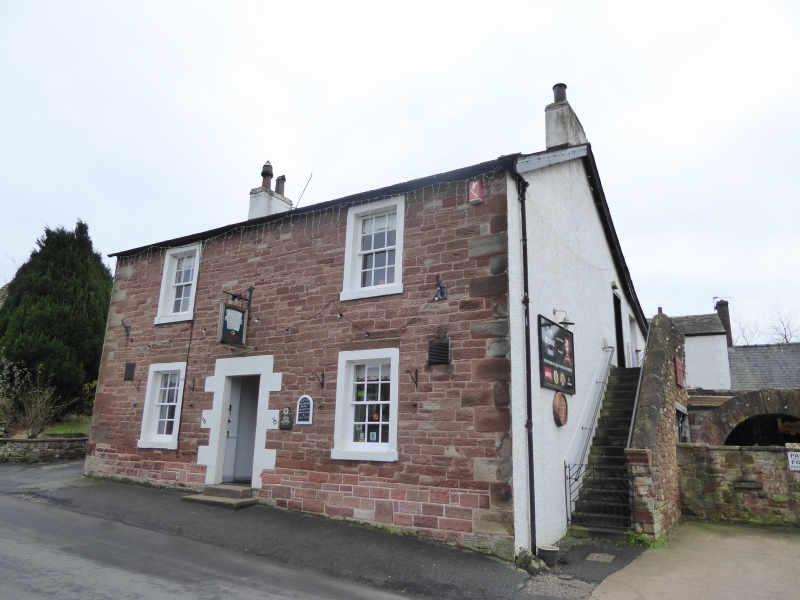
Entry Name: The Stone Inn
Listing Date: 28 March 1984
Grade: II
Source: Historic England
Source ID: 1335585
English Heritage Legacy ID: 78042
ID on this website: 101335585
Location: Hayton, Cumberland, Cumbria, CA8
County: Cumbria
District: Carlisle
Civil Parish: Hayton
Built-Up Area: Hayton
Traditional County: Cumberland
Lieutenancy Area (Ceremonial County): Cumbria
Church of England Parish: Hayton St Mary Magdalene
Church of England Diocese: Carlisle
Tagged with: Inn
NY 55 NW HAYTON HAYTON
5/51 The Stone Inn
II
Public House. Early C19. Hammer-dressed red sandstone with flush quoins, slate
roof, rendered chimney stacks. 2 storeys, 2 bays. 6 panel door has painted
quoined surround. Sash windows with glazing bars have plain painted stone
surrounds. Rendered end walls.
Listing NGR: NY5071857724
External links are from the relevant listing authority and, where applicable, Wikidata. Wikidata IDs may be related buildings as well as this specific building. If you want to add or update a link, you will need to do so by editing the Wikidata entry.


Other nearby listed buildings
