Approximate Location Map
Large Map »
Latitude: 51.7937 / 51°47'37"N
Longitude: -2.4267 / 2°25'36"W
OS Eastings: 370665
OS Northings: 210651
OS Grid: SO706106
Mapcode National: GBR FZ.Y0NS
Mapcode Global: VH875.W5FR
Plus Code: 9C3VQHVF+F8
Entry Name: Clark Monument, About 8M South of South Porch in Churchyard of Church of St Mary
Listing Date: 9 December 1986
Grade: II
Source: Historic England
Source ID: 1340706
English Heritage Legacy ID: 132272
ID on this website: 101340706
Location: St Mary's Church, Arlingham, Stroud, Gloucestershire, GL2
County: Gloucestershire
District: Stroud
Civil Parish: Arlingham
Built-Up Area: Arlingham
Traditional County: Gloucestershire
Lieutenancy Area (Ceremonial County): Gloucestershire
Church of England Parish: Arlingham St Mary the Virgin
Church of England Diocese: Gloucester
Tagged with: Monument
ARLINGHAM CHURCH ROAD
SO 71 SW
(west side)
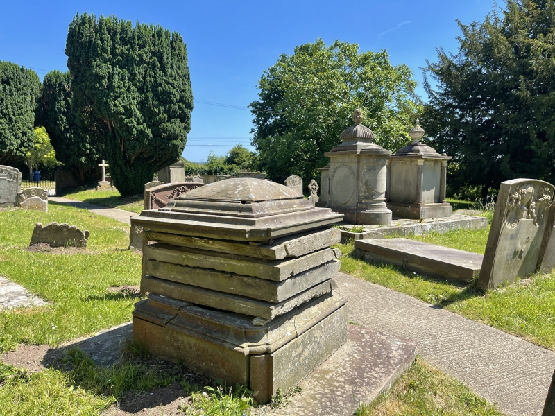
2/14 Clark Monument, about 8m south
of south porch in churchyard of
Church of St. Mary
GV II
Pedestal tomb. Elizabeth Clark 1807. Forest limestone. Curved
pyramidal cap with plain finial. Slightly indented corners with
reeded quarter columns. Tall moulded plinth on base. Plain east
and west sides with tooled edges, slightly raised ovals to north
and south with palm leaves over. Top slightly crooked at time of
survey (November 1985).
Listing NGR: SO7066510651
External links are from the relevant listing authority and, where applicable, Wikidata. Wikidata IDs may be related buildings as well as this specific building. If you want to add or update a link, you will need to do so by editing the Wikidata entry.


Other nearby listed buildings
