Approximate Location Map
Large Map »
Latitude: 52.3254 / 52°19'31"N
Longitude: -2.0433 / 2°2'35"W
OS Eastings: 397144
OS Northings: 269698
OS Grid: SO971696
Mapcode National: GBR 2G5.07N
Mapcode Global: VH9ZL.JTM7
Plus Code: 9C4V8XG4+4M
Entry Name: Archway Immediately to the North East of No 39
Listing Date: 14 May 1975
Grade: II
Source: Historic England
Source ID: 1348493
English Heritage Legacy ID: 155757
ID on this website: 101348493
Location: Aston Fields, Bromsgrove, Worcestershire, B60
County: Worcestershire
District: Bromsgrove
Electoral Ward/Division: Aston Fields
Parish: Non Civil Parish
Built-Up Area: Bromsgrove
Traditional County: Worcestershire
Lieutenancy Area (Ceremonial County): Worcestershire
Church of England Parish: Bromsgrove
Church of England Diocese: Worcester
Tagged with: Archway
FINSTALL ROAD
1.
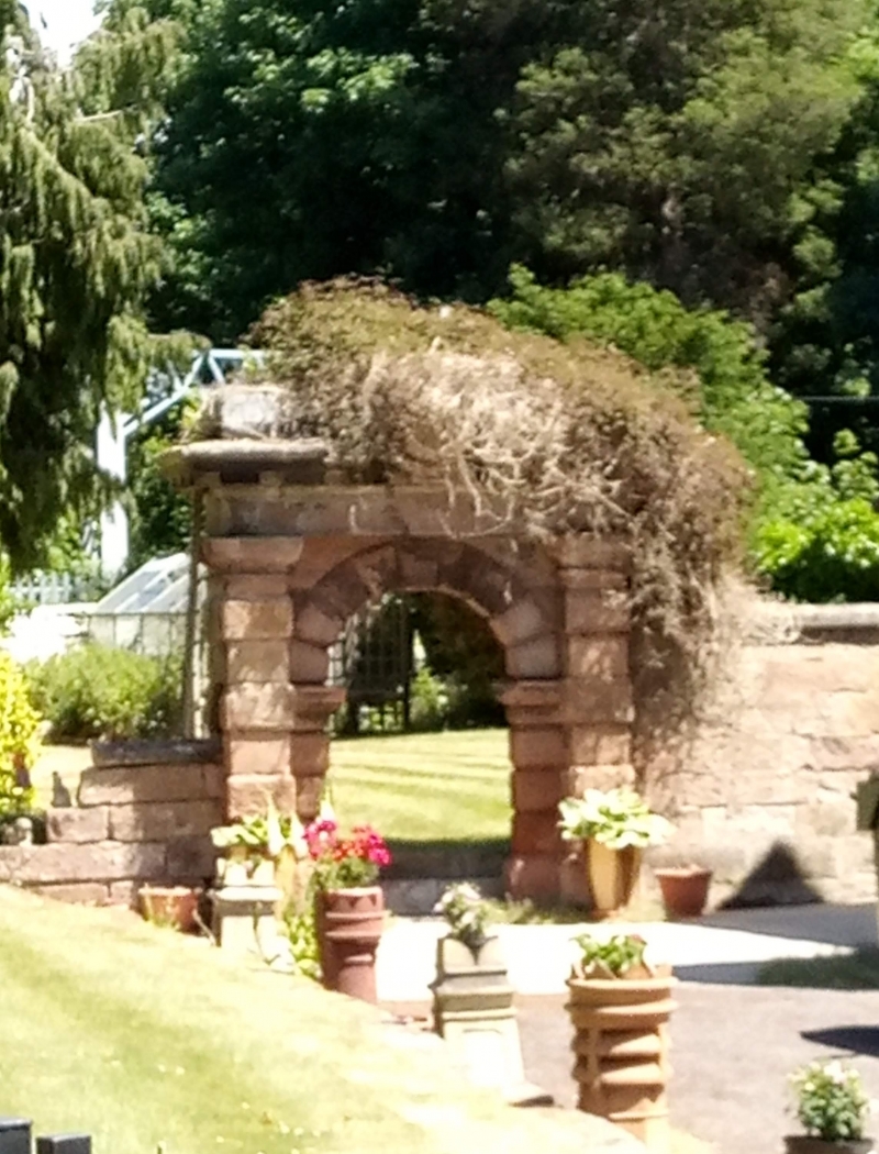
909 ASTON FIELDS
Archway immediately to
the North East of No 39
SO 96 NE 6/143
II
2.
Probably mid to late C19. Sandstone arched gateway. Heavy entablature with flat
pediment with central raised part with shield, wide modilloned cornice, all
supported on square piers with verniculated rustication and moulded capitals, between
which is inset semi-circular arch with rusticated voussoirs, keystone and moulded
impost on rusticated pilasters.
Listing NGR: SO9714469698
External links are from the relevant listing authority and, where applicable, Wikidata. Wikidata IDs may be related buildings as well as this specific building. If you want to add or update a link, you will need to do so by editing the Wikidata entry.


Other nearby listed buildings
