Latitude: 53.4089 / 53°24'32"N
Longitude: -2.1653 / 2°9'55"W
OS Eastings: 389105
OS Northings: 390246
OS Grid: SJ891902
Mapcode National: GBR FYB0.0Q
Mapcode Global: WHB9W.QL20
Plus Code: 9C5VCR5M+HV
Entry Name: Stockport Railway Viaduct
Listing Date: 10 March 1975
Grade: II*
Source: Historic England
Source ID: 1356861
English Heritage Legacy ID: 210778
ID on this website: 101356861
Location: Stockport, Greater Manchester, SK3
County: Stockport
Electoral Ward/Division: Edgeley and Cheadle Heath
Parish: Non Civil Parish
Built-Up Area: Stockport
Traditional County: Cheshire
Lieutenancy Area (Ceremonial County): Greater Manchester
Church of England Parish: Stockport St Peter
Church of England Diocese: Chester
Tagged with: Architectural structure Railway viaduct
This list entry was subject to a Minor Amendment on 19 December 2024 to amend details in the description and Source and to reformat the text to current standards
SJ 8990
SW 3/32
VIADUCT STREET
Stockport Railway Viaduct
(Formerly listed as Railway Viaduct, Stockport)
II*
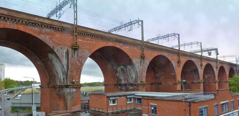
Railway viaduct opened 1840 by GW Buck for Manchester and Birmingham Railway in brick and stone. 28 arches of total length over 540m (three spans at either end of 18ft, 22 spans between of 63ft), and nearly 34m high above the river. Said to contain 11 million bricks, viaduct in brick with stone capping and dentil cornice. Stone moulded impost bands and rusticated faces to piers. Took 21 months to build, at a cost of £72,700. Widened to the west 1888 to 1889.
Listing NGR: SJ8910590246
External links are from the relevant listing authority and, where applicable, Wikidata. Wikidata IDs may be related buildings as well as this specific building. If you want to add or update a link, you will need to do so by editing the Wikidata entry.


Other nearby listed buildings