Approximate Location Map
Large Map »
Latitude: 51.3163 / 51°18'58"N
Longitude: 0.8897 / 0°53'23"E
OS Eastings: 601473
OS Northings: 161433
OS Grid: TR014614
Mapcode National: GBR SW3.HR5
Mapcode Global: VHKJW.C5QR
Plus Code: 9F328V8Q+GV
Entry Name: JH Johnson's Warehouse
Listing Date: 3 August 1972
Grade: II
Source: Historic England
Source ID: 1360990
English Heritage Legacy ID: 438512
ID on this website: 101360990
Location: Faversham, Swale, Kent, ME13
County: Kent
District: Swale
Civil Parish: Faversham
Built-Up Area: Faversham
Traditional County: Kent
Lieutenancy Area (Ceremonial County): Kent
Tagged with: Architectural structure
TR 0161 SW 2/102
1103
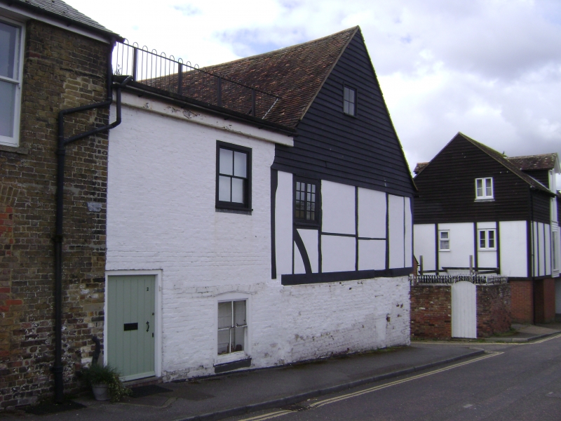
WATER LANE
J H Johnson's Warehouse
II
Timber-framed building with the 1st floor over-hanging on a bressummer and tile
protruding ends of the floor joists. The ground floor has been rebuilt in brick,
painted, but the timbering is visible above with painted brick infilling. Tiled
roof. Modern windows. 2 storeys. 3 windows.
Listing NGR: TR0147361433
External links are from the relevant listing authority and, where applicable, Wikidata. Wikidata IDs may be related buildings as well as this specific building. If you want to add or update a link, you will need to do so by editing the Wikidata entry.


Other nearby listed buildings
