Latitude: 51.3161 / 51°18'57"N
Longitude: 0.8897 / 0°53'22"E
OS Eastings: 601470
OS Northings: 161406
OS Grid: TR014614
Mapcode National: GBR SW3.HR7
Mapcode Global: VHKJW.C5PX
Plus Code: 9F328V8Q+CV
Entry Name: 13, West Street
Listing Date: 3 August 1972
Grade: II
Source: Historic England
Source ID: 1356636
English Heritage Legacy ID: 438532
ID on this website: 101356636
Location: Faversham, Swale, Kent, ME13
County: Kent
District: Swale
Civil Parish: Faversham
Built-Up Area: Faversham
Traditional County: Kent
Lieutenancy Area (Ceremonial County): Kent
Tagged with: Building
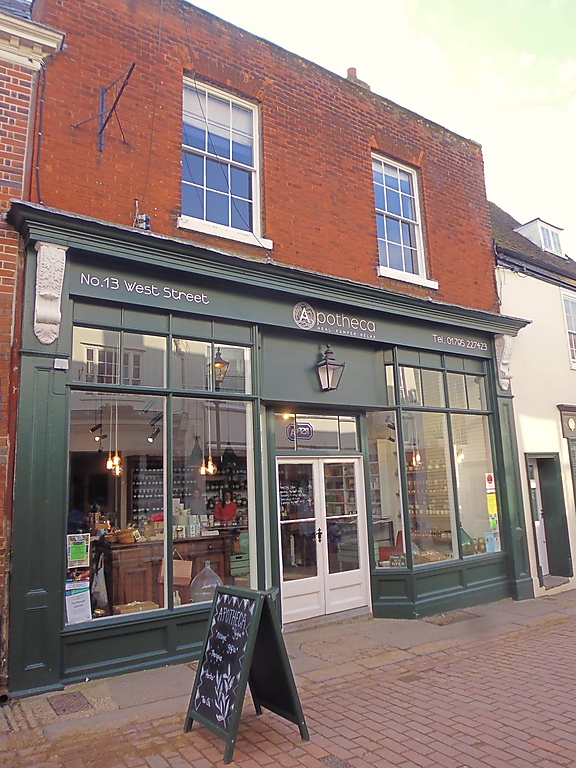
WEST STREET
1.
1103 (South Side)
------------
No 13
TR 0161 SW 2/300
II
2.
Late C18. 2 storeys. 2-bays. Parapet with capping. Windows 3 panes
wide in reveals; rubbed brick voussoir. Deep modern fascia with
moulded cornice over; modern shop front beneath with pilasters at
either end.
Listing NGR: TR0146861402
External links are from the relevant listing authority and, where applicable, Wikidata. Wikidata IDs may be related buildings as well as this specific building. If you want to add or update a link, you will need to do so by editing the Wikidata entry.


Other nearby listed buildings