Latitude: 52.2429 / 52°14'34"N
Longitude: 0.712 / 0°42'43"E
OS Eastings: 585254
OS Northings: 263984
OS Grid: TL852639
Mapcode National: GBR QF0.6V4
Mapcode Global: VHKD4.9W7H
Plus Code: 9F426PV6+4Q
Entry Name: Portland House
Listing Date: 7 August 1952
Grade: II
Source: Historic England
Source ID: 1363710
English Heritage Legacy ID: 466869
ID on this website: 101363710
Location: Bury St Edmunds, West Suffolk, IP33
County: Suffolk
District: West Suffolk
Civil Parish: Bury St Edmunds
Built-Up Area: Bury St Edmunds
Traditional County: Suffolk
Lieutenancy Area (Ceremonial County): Suffolk
Church of England Parish: Bury St Edmunds St Mary
Church of England Diocese: St.Edmundsbury and Ipswich
Tagged with: House
BURY ST EDMUNDS
TL8563NW GUILDHALL STREET 639-1/15/396 (West side) 07/08/52 No.74 Portland House
GV II
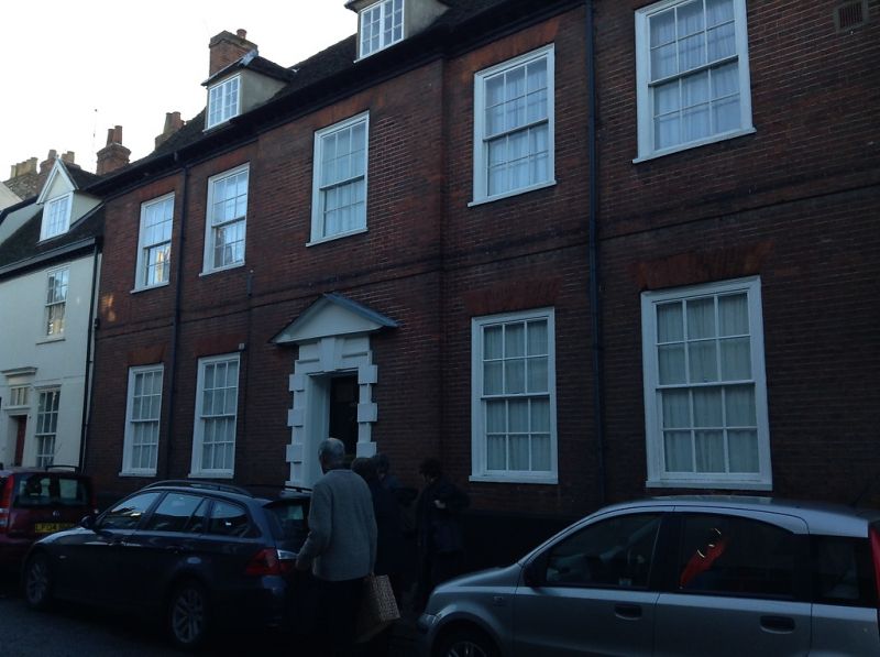
House, now divided into flats. Early to mid C18. Timber-framed, fronted in red brick; plaintiled roof with a wood modillion eaves cornice. EXTERIOR: 2 storeys, attics and cellar. 5 window range, arranged 2:1:2 with the centre breaking forward slightly: all 12-pane sashes in flush cased frames with flat gauged arches. A raised brick band between the storeys and another immediately below the cornice. 3 hipped dormers have small-paned casement windows. The recessed central 6-panel door is set in a Gibbs surround with rusticated architraves, cornice and pediment. INTERIOR: not inspected, but said to have been completely modernised, with all historic features concealed or removed. (BOE: Pevsner N: Radcliffe E: Suffolk: London: 1974-: 151).
Listing NGR: TL8525463984
External links are from the relevant listing authority and, where applicable, Wikidata. Wikidata IDs may be related buildings as well as this specific building. If you want to add or update a link, you will need to do so by editing the Wikidata entry.


Other nearby listed buildings