Latitude: 52.2445 / 52°14'40"N
Longitude: 0.7118 / 0°42'42"E
OS Eastings: 585237
OS Northings: 264170
OS Grid: TL852641
Mapcode National: GBR QF0.6SG
Mapcode Global: VHKD4.9V56
Plus Code: 9F426PV6+RP
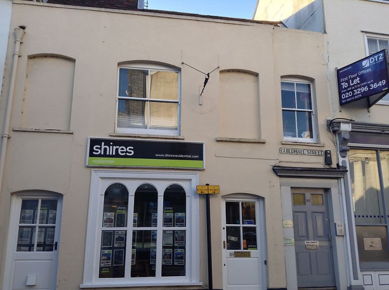
Entry Name: 89, Guildhall Street
Listing Date: 12 July 1972
Grade: II
Source: Historic England
Source ID: 1363724
English Heritage Legacy ID: 466883
ID on this website: 101363724
Location: Bury St Edmunds, West Suffolk, IP33
County: Suffolk
District: West Suffolk
Civil Parish: Bury St Edmunds
Built-Up Area: Bury St Edmunds
Traditional County: Suffolk
Lieutenancy Area (Ceremonial County): Suffolk
Church of England Parish: Bury St Edmunds St Mary
Church of England Diocese: St.Edmundsbury and Ipswich
Tagged with: Building
BURY ST EDMUNDS
TL8564SW GUILDHALL STREET
639-1/14/410 (West side)
12/07/72 No.89
GV II
House, now offices. Early C19 front, with C20 alterations;
possible older core. Stucco over brick with a plain parapet;
plaintiled roof on 2 levels. INTERIOR: not inspected.
Listing NGR: TL8523764170
External links are from the relevant listing authority and, where applicable, Wikidata. Wikidata IDs may be related buildings as well as this specific building. If you want to add or update a link, you will need to do so by editing the Wikidata entry.


Other nearby listed buildings