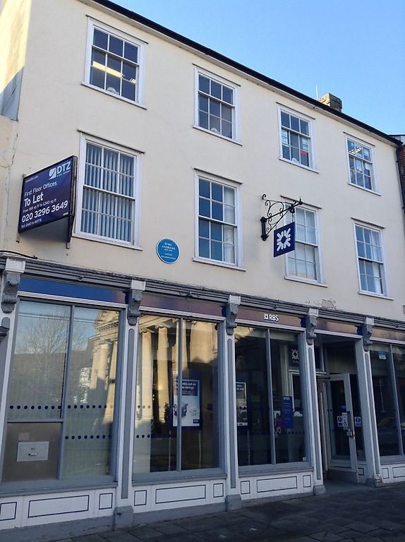
Latitude: 52.2446 / 52°14'40"N
Longitude: 0.7118 / 0°42'42"E
OS Eastings: 585235
OS Northings: 264180
OS Grid: TL852641
Mapcode National: GBR QF0.6SF
Mapcode Global: VHKD4.9V54
Plus Code: 9F426PV6+RP
Entry Name: Royal Bank of Scotland
Listing Date: 12 July 1972
Grade: II
Source: Historic England
Source ID: 1363725
English Heritage Legacy ID: 466884
ID on this website: 101363725
Location: Bury St Edmunds, West Suffolk, IP33
County: Suffolk
District: West Suffolk
Civil Parish: Bury St Edmunds
Built-Up Area: Bury St Edmunds
Traditional County: Suffolk
Lieutenancy Area (Ceremonial County): Suffolk
Church of England Parish: Bury St Edmunds St Mary
Church of England Diocese: St.Edmundsbury and Ipswich
Tagged with: Bank building
BURY ST EDMUNDS
TL8564SW GUILDHALL STREET 639-1/14/411 (West side) 12/07/72 No.90 Royal Bank of Scotland
GV II
Shop and house; now bank premises. Early C19 front, modernised in 1980s; later C17 to part of rear. Timber-framed and rendered; slate roofs. EXTERIOR: 3 storeys and cellars. 4 window range: 12-pane sashes to the 1st storey, 9-pane to the 2nd, all in moulded flush cased frames. The ground storey has a double shop front with central entrance door, altered in the 1980s, with pilasters, frieze and a cornice with 6 C19 ornate console brackets. Another entrance door on the extreme left is structurally part of No.89(qv). INTERIOR: extensive cellars contain no visible features of interest.
Listing NGR: TL8523564180
External links are from the relevant listing authority and, where applicable, Wikidata. Wikidata IDs may be related buildings as well as this specific building. If you want to add or update a link, you will need to do so by editing the Wikidata entry.


Other nearby listed buildings