Latitude: 52.242 / 52°14'31"N
Longitude: 0.7122 / 0°42'43"E
OS Eastings: 585270
OS Northings: 263890
OS Grid: TL852638
Mapcode National: GBR QF0.DVG
Mapcode Global: VHKD4.9XB4
Plus Code: 9F426PR6+RV
Entry Name: 66 and 67, Guildhall Street
Listing Date: 7 August 1952
Grade: II
Source: Historic England
Source ID: 1363744
English Heritage Legacy ID: 466862
ID on this website: 101363744
Location: Bury St Edmunds, West Suffolk, IP33
County: Suffolk
District: West Suffolk
Civil Parish: Bury St Edmunds
Built-Up Area: Bury St Edmunds
Traditional County: Suffolk
Lieutenancy Area (Ceremonial County): Suffolk
Church of England Parish: Bury St Edmunds St Mary
Church of England Diocese: St.Edmundsbury and Ipswich
Tagged with: Building
BURY ST EDMUNDS
TL8563NW GUILDHALL STREET 639-1/15/389 (West side) 07/08/52 Nos.66 AND 67
GV II
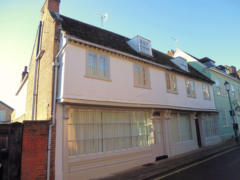
House and 2 shops. C16 with an early C18 front. Timber-framed and jettied, rendered on the upper storey with raised roughcast panels; red brick to south gable end; plaintiled roof with a wood modillion eaves cornice. EXTERIOR: 2 storeys, attics and cellars. 5 windows to the upper storey, all 2-light small-paned casements in flush frames. The joist ends of the jetty are covered by a plain wood fascia and the overhang is supported by 7 heavily moulded console brackets. A small section at the north end is unjettied. The ground storey has 2 separate early C19 shop fronts with 3 windows in all, the 2 outer small-paned, the middle with plate glass. Both fronts have panelled stall boards. 2 flat-headed lead-covered dormers with rendered cheeks have 6-pane sash windows. INTERIOR: not inspected, but reputed to contain features of interest. (BOE: Pevsner N: Radcliffe E: Suffolk: London: 1974-: 151).
Listing NGR: TL8527063890
External links are from the relevant listing authority and, where applicable, Wikidata. Wikidata IDs may be related buildings as well as this specific building. If you want to add or update a link, you will need to do so by editing the Wikidata entry.


Other nearby listed buildings