Approximate Location Map
Large Map »
Latitude: 52.6039 / 52°36'13"N
Longitude: -2.5552 / 2°33'18"W
OS Eastings: 362496
OS Northings: 300822
OS Grid: SJ624008
Mapcode National: GBR BS.93MY
Mapcode Global: WH9DF.QTF5
Plus Code: 9C4VJC3V+HW
Entry Name: The Old Windmill to West of Shadwell Rock Quarry
Listing Date: 9 March 1970
Grade: II
Source: Historic England
Source ID: 1367528
English Heritage Legacy ID: 254765
ID on this website: 101367528
Location: Shropshire, TF13
County: Shropshire
Civil Parish: Much Wenlock
Traditional County: Shropshire
Lieutenancy Area (Ceremonial County): Shropshire
Church of England Parish: Much Wenlock with Bourton
Church of England Diocese: Hereford
Tagged with: Windmill
1.
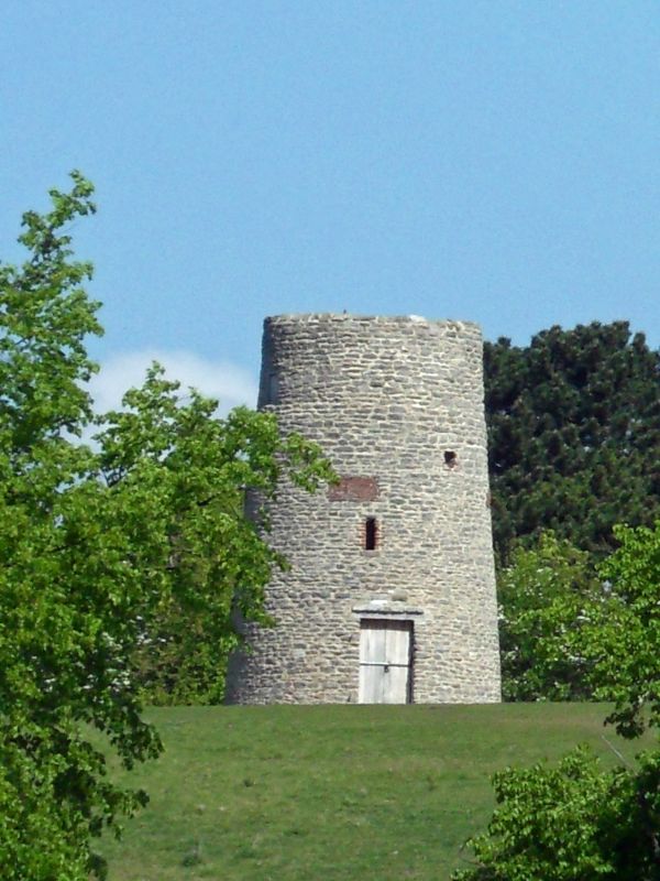
1954 MUCH WENLOCK
The Old Windmill to
west of Shadwell
Rock Quarry
SJ 60 SW (SJ 62 00) 6/106 9.3.70.
II
i
2.
C18. Four storey stone rubble tapering circular tower with damaged battlemented
parapet. Ruinous and with no interior features. A prominent landmark.
Listing NGR: SJ6249600822
External links are from the relevant listing authority and, where applicable, Wikidata. Wikidata IDs may be related buildings as well as this specific building. If you want to add or update a link, you will need to do so by editing the Wikidata entry.


Other nearby listed buildings
