Latitude: 51.6441 / 51°38'38"N
Longitude: -1.6123 / 1°36'44"W
OS Eastings: 426922
OS Northings: 193992
OS Grid: SU269939
Mapcode National: GBR 5VV.TD5
Mapcode Global: VHC0L.0YH0
Plus Code: 9C3WJ9VQ+J3
Entry Name: Shelter Shed with Granary
Listing Date: 23 November 1990
Grade: II
Source: Historic England
Source ID: 1368113
English Heritage Legacy ID: 251576
ID on this website: 101368113
Location: Great Coxwell, Vale of White Horse, Oxfordshire, SN7
County: Oxfordshire
District: Vale of White Horse
Civil Parish: Great Coxwell
Traditional County: Berkshire
Lieutenancy Area (Ceremonial County): Oxfordshire
Church of England Parish: Great Coxwell
Church of England Diocese: Oxford
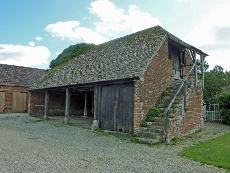
GREAT COXWELL SU29SE Shelter shed with 4/124 granary GV II Shelter shed with granary over. C18, probably mid. Red brick with some blue headers in Flemish bond; stone slate roof. One storey with loft; 4x2 bays. Open-fronted having jowelled wall posts standing on chamfered padstones; double board door to right bay. Half-hipped roof. On right side, brick and stone steps up to board loft door which has side-lights and pent porch. Left return has C20 3-light window to gable. Interior: large scantling chamfered cross-beams with run-out stops supported by wall posts at front and by similar line of posts across centre; right-hand bay divided off by weatherboard partition; left-hand wall has mortices, probably from former manger-holding beams, and this bay is partly divided off by slatted partitioning; loft trap-door to bay 3.
Listing NGR: SU2692593994
External links are from the relevant listing authority and, where applicable, Wikidata. Wikidata IDs may be related buildings as well as this specific building. If you want to add or update a link, you will need to do so by editing the Wikidata entry.


Other nearby listed buildings