Latitude: 51.6717 / 51°40'17"N
Longitude: -0.9683 / 0°58'6"W
OS Eastings: 471438
OS Northings: 197490
OS Grid: SU714974
Mapcode National: GBR C34.20V
Mapcode Global: VHDVV.57FV
Plus Code: 9C3XM2CJ+MM
Entry Name: Home Farmhouse
Listing Date: 28 February 1979
Grade: II
Source: Historic England
Source ID: 1368882
English Heritage Legacy ID: 248952
ID on this website: 101368882
Location: Lewknor, South Oxfordshire, OX49
County: Oxfordshire
District: South Oxfordshire
Civil Parish: Lewknor
Built-Up Area: Lewknor
Traditional County: Oxfordshire
Lieutenancy Area (Ceremonial County): Oxfordshire
Church of England Parish: Lewknor
Church of England Diocese: Oxford
Tagged with: Farmhouse Thatched cottage
LEWKNOR HILL ROAD SU7197 (West side) 10/106 Home Farmhouse 28/02/79
GV II
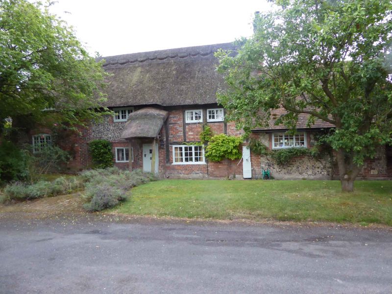
Farmhouse, extended as 3 cottages c.1830, now house. C16, partly refaced in early C18: early C19 left bay. Originally timber-framed: rectangular heavy timber framing with early C19 brick infill to right. Left bay and rear clad in knapped flint rubble with brick dressings: early C19 left bay of Flemish bond brick with flared headers and partly flint rubble. Gabled thatch roof; brick end and internal stacks. 2- extended to 3-unit plan. 2 storeys; 3-window range. C20 and C19 two-light casements over C20 door and casement to right: centre bay has blocked door and gauged brick flat arch over 2-light leaded casement: C19 three-light casement above. Left bay has blocked door and C20 dormer casement above segmental-arched late C19 three-light casement. C18 one-storey, one-bay extension to right of flint rubble with hipped thatch roof. Interior: chamfered and stopped beams, open fireplace, queen-post roof.
Listing NGR: SU7143897490
External links are from the relevant listing authority and, where applicable, Wikidata. Wikidata IDs may be related buildings as well as this specific building. If you want to add or update a link, you will need to do so by editing the Wikidata entry.


Other nearby listed buildings