Latitude: 51.5391 / 51°32'20"N
Longitude: -0.901 / 0°54'3"W
OS Eastings: 476316
OS Northings: 182821
OS Grid: SU763828
Mapcode National: GBR C4S.F1G
Mapcode Global: VHDWG.BKJY
Plus Code: 9C3XG3QX+MH
Entry Name: 1, Wharfe Lane
Listing Date: 28 October 1974
Grade: II
Source: Historic England
Source ID: 1369170
English Heritage Legacy ID: 246367
ID on this website: 101369170
Location: Henley-on-Thames, South Oxfordshire, RG9
County: Oxfordshire
District: South Oxfordshire
Civil Parish: Henley-on-Thames
Built-Up Area: Henley-on-Thames
Traditional County: Oxfordshire
Lieutenancy Area (Ceremonial County): Oxfordshire
Church of England Parish: Henley-on-Thames
Church of England Diocese: Oxford
Tagged with: Building
1. WHARF LANE 5355 (East Side)
No 1 SU 7582 1/392
II GV
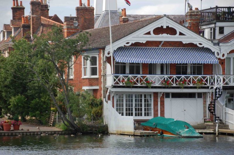
2. C19. Very important focal position with elevations to Wharfe Lane and to the River Thames; also terminates the new along Thameside at the junction of Thameside and New Street. Red brick with white brick quoins, door and window dressings. Modern pantiled roof. 2 storeys. Wharfe lane elevation 2 storeys, 3 windows, sashes with late C19 glazing - garage and house door ground floor. Thameside elevation has 4 unbarred sashes and central door, eastern bay forms a separate unit with oriel canted bay on 1st floor. Additional garage door ground floor. River elevation has gable end with fretted bargeboard. 1 st floor balcony, 3 bay facade. Windows, - 2 light sashes with segmental arches. Ground floor has 2 boathouses.
No 1 forms part of a group with Nos 25 to 29 (odd) Thameside and No 88 New Street and the surface of the courtyard behind No 88. It also forms part of a second group with all the listed buildings on Wharfe Lane.
Listing NGR: SU7631682821
External links are from the relevant listing authority and, where applicable, Wikidata. Wikidata IDs may be related buildings as well as this specific building. If you want to add or update a link, you will need to do so by editing the Wikidata entry.


Other nearby listed buildings