Approximate Location Map
Large Map »
Latitude: 51.5756 / 51°34'32"N
Longitude: -0.9911 / 0°59'27"W
OS Eastings: 470014
OS Northings: 186783
OS Grid: SU700867
Mapcode National: GBR B2Y.28M
Mapcode Global: VHDW6.RNXJ
Plus Code: 9C3XH2G5+6H
Entry Name: The Small House
Listing Date: 13 February 1985
Grade: II
Source: Historic England
Source ID: 1369330
English Heritage Legacy ID: 247126
ID on this website: 101369330
Location: Nettlebed, South Oxfordshire, RG9
County: Oxfordshire
District: South Oxfordshire
Civil Parish: Nettlebed
Built-Up Area: Nettlebed
Traditional County: Oxfordshire
Lieutenancy Area (Ceremonial County): Oxfordshire
Church of England Parish: Nettlebed with Highmoor
Church of England Diocese: Oxford
Tagged with: House
NETTLEBED HIGH STREET
SU7086
(South side)
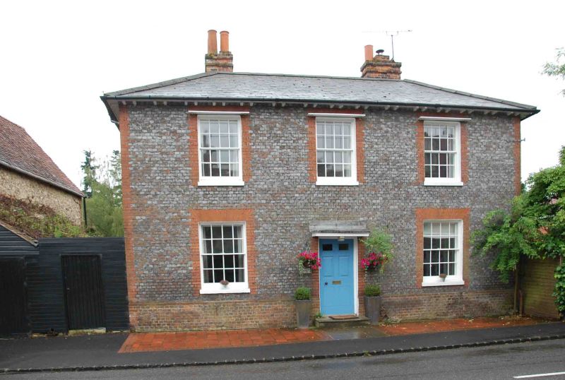
13/104 No.27 (The Small House)
GV II
Town house. Late C18. Grey brick with red brick dressing; slate roof; brick
stacks. Double depth plan. 2-storey 3 window range. Central 6-panel part glazed
door with flat hood. 16-pane sashes to all openings. Bracketed eaves.
Hipped roof with valley to rear. Brick ridge stacks to left and right returns.
Interior: contemporary staircase, dog leg with landing.
Listing NGR: SU7005086762
External links are from the relevant listing authority and, where applicable, Wikidata. Wikidata IDs may be related buildings as well as this specific building. If you want to add or update a link, you will need to do so by editing the Wikidata entry.


Other nearby listed buildings
