Latitude: 53.7976 / 53°47'51"N
Longitude: -1.5428 / 1°32'33"W
OS Eastings: 430215
OS Northings: 433569
OS Grid: SE302335
Mapcode National: GBR BKL.5G
Mapcode Global: WHC9D.8TL3
Plus Code: 9C5WQFX4+2V
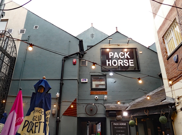
Entry Name: Pack Horse Public House
Listing Date: 11 January 1983
Last Amended: 11 September 1996
Grade: II
Source: Historic England
Source ID: 1375383
English Heritage Legacy ID: 466279
ID on this website: 101375383
Location: The Leylands, Leeds, West Yorkshire, LS1
County: Leeds
Electoral Ward/Division: City and Hunslet
Parish: Non Civil Parish
Built-Up Area: Leeds
Traditional County: Yorkshire
Lieutenancy Area (Ceremonial County): West Yorkshire
Church of England Parish: Leeds City
Church of England Diocese: Leeds
Tagged with: Pub
LEEDS
SE3033NW PACK HORSE YARD 714-1/76/281 (North side) 11/01/83 Pack Horse Public House (Formerly Listed as: PACK HORSE YARD Timber-framed building between Minor and Scurr's and Pack Horse Yards)
II
Public house with remains of timber-framed building. Late C16-early C17, incorporated into the c1988 restoration of the public house. Single bay of a 2-storey structure which probably originally extended further east. Parts of framing to N, W and S walls survive together with the W king post truss, floor framing and rafters. The timbers show evidence for re-use in their present position, indicating their removal from an earlier timber building; the structure is no longer load-bearing. INTERIOR: not inspected. An important survival of the type of structure characteristic of Leeds prior to the extensive rebuilding of the city centre in the C19. (Michelmore D (Leeds Planning Dept): Report on timber-framed building at SE 30211 33572: 1982-).
Listing NGR: SE3021533569
External links are from the relevant listing authority and, where applicable, Wikidata. Wikidata IDs may be related buildings as well as this specific building. If you want to add or update a link, you will need to do so by editing the Wikidata entry.


Other nearby listed buildings