Latitude: 52.246 / 52°14'45"N
Longitude: 0.72 / 0°43'11"E
OS Eastings: 585788
OS Northings: 264356
OS Grid: TL857643
Mapcode National: GBR QF0.2W7
Mapcode Global: VHKD4.FTH2
Plus Code: 9F426PW9+CX
Entry Name: Abbots Bridge and Adjoining East Precinct Wall
Listing Date: 7 August 1952
Grade: I
Source: Historic England
Source ID: 1375552
English Heritage Legacy ID: 466453
ID on this website: 101375552
Location: Bury St Edmunds, West Suffolk, IP33
County: Suffolk
District: West Suffolk
Civil Parish: Bury St Edmunds
Built-Up Area: Bury St Edmunds
Traditional County: Suffolk
Lieutenancy Area (Ceremonial County): Suffolk
Church of England Parish: St James Bury St Edmunds
Church of England Diocese: St.Edmundsbury and Ipswich
Tagged with: Bridge
BURY ST EDMUNDS
TL8564SE ABBEY PRECINCTS 639-1/8/97 Abbot's Bridge and adjoining east 07/08/52 Precinct wall
GV I
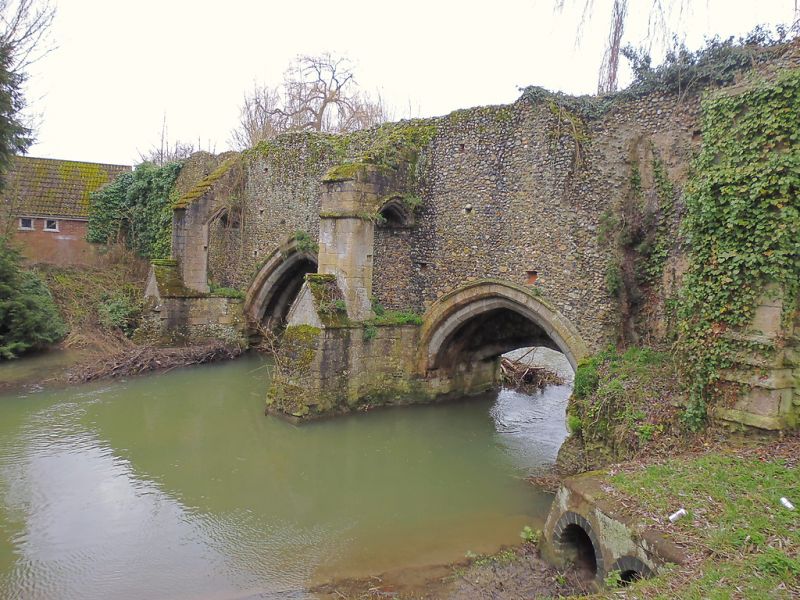
Monastic bridge across the River Lark at the north-west corner of the Abbey Precincts. Late C12 with C14 additions. In rubble flint and stone with freestone to buttresses and arches. A central pointed arch and flanking segmental arches on the north-east face carry the precinct wall, with 2 C14 breakwaters and 2 flying buttresses added between the arches. On the south-west face 3 segmental arches, each said to have formerly carried a portcullis, support a walkway which links the bridge with the C12 precinct wall leading to the vineyards on the east side of the river. In coursed and rubble flint, in parts more than 2 metres high, this wall extends some 98 metres to join the remains of the north wall of the vineyards. A short stretch of ashlar-faced return wall ends with a buttress on the river bank. Scheduled Ancient Monument. (BOE: Pevsner N: Radcliffe E: Suffolk: London: 1974-: 140).
Listing NGR: TL8578864356
External links are from the relevant listing authority and, where applicable, Wikidata. Wikidata IDs may be related buildings as well as this specific building. If you want to add or update a link, you will need to do so by editing the Wikidata entry.


Other nearby listed buildings