Latitude: 53.1871 / 53°11'13"N
Longitude: -2.8906 / 2°53'26"W
OS Eastings: 340585
OS Northings: 365931
OS Grid: SJ405659
Mapcode National: GBR 7B.36C3
Mapcode Global: WH88F.K5Q0
Plus Code: 9C5V54P5+VQ
Entry Name: 5, Castle Street
Listing Date: 10 January 1972
Grade: II
Source: Historic England
Source ID: 1376112
English Heritage Legacy ID: 470102
ID on this website: 101376112
Location: Chester, Cheshire West and Chester, Cheshire, CH1
County: Cheshire West and Chester
Electoral Ward/Division: Chester City
Parish: Non Civil Parish
Built-Up Area: Chester
Traditional County: Cheshire
Lieutenancy Area (Ceremonial County): Cheshire
Church of England Parish: Chester St John the Baptist
Church of England Diocese: Chester
CHESTER CITY (IM)
SJ4065NE CASTLE STREET 595-1/6/94 (South side) 10/01/72 No.5
GV II
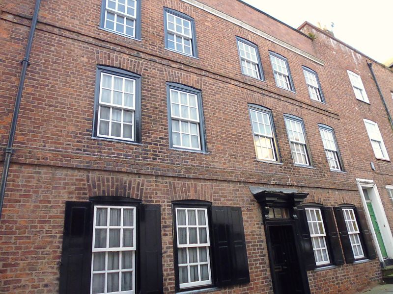
Town house. Mid C18, probably with earlier core. Flemish bond brown brick; grey slate roof, ridge parallel with front. 3 storeys of 5 bays plus loft in roof. Flush sandstone plinth, mostly replaced in brick east of doorway. One stone step to panelled door in panelled case with 3-pane overlight and heavy moulded hood on consoles. All sashes are nearly flush, of 12 panes with thick glazing-bars, lead apron-sills and cambered gauged brick arches; 2 sashes to each side of door, with hinged panelled shutters; 5 sashes to second and third storeys, irregularly spaced. 3-course floorband to second storey; band of one course oversailing 2 courses to third storey. Cast-iron rainwater pipe with C18 moulded lead head; moulded cornice beneath rebuilt parapet. The rear has a round-arched stair window and a pair of 2-light windows in a loft dormer, with a large chimney on rear roof-slope to each side. INTERIOR not inspected.
Listing NGR: SJ4058565931
External links are from the relevant listing authority and, where applicable, Wikidata. Wikidata IDs may be related buildings as well as this specific building. If you want to add or update a link, you will need to do so by editing the Wikidata entry.


Other nearby listed buildings