Latitude: 53.1926 / 53°11'33"N
Longitude: -2.8995 / 2°53'58"W
OS Eastings: 339997
OS Northings: 366544
OS Grid: SJ399665
Mapcode National: GBR 79.2XWN
Mapcode Global: WH88F.F0HT
Plus Code: 9C5V54V2+25
Entry Name: Spur Wall and Water Tower
Listing Date: 28 July 1955
Last Amended: 6 August 1998
Grade: I
Source: Historic England
Source ID: 1376129
English Heritage Legacy ID: 470119
ID on this website: 101376129
Location: Water Tower Gardens, Chester, Cheshire West and Chester, Cheshire, CH1
County: Cheshire West and Chester
Electoral Ward/Division: Garden Quarter
Parish: Non Civil Parish
Built-Up Area: Chester
Traditional County: Cheshire
Lieutenancy Area (Ceremonial County): Cheshire
Church of England Parish: Chester St Oswald and St Thomas of Canterbury
Church of England Diocese: Chester
Tagged with: Museum Fortified tower
CHESTER CITY (IM)
SJ4066NW CITY WALLS 595-1/1/101 Spur wall and Water Tower 28/07/55 (Formerly Listed as: City Walls & Towers incl. foundations of SE angle Roman Fortress wall & tower)
GV I
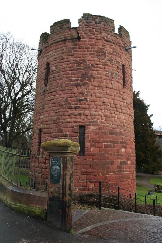
Spur wall from Bonewaldesthorne Tower (qv) to the Water Tower, and the Water Tower. 1322-6. By John Helpstone. Approx 37m long and 3.3m wide. Coursed red sandstone rubble. EXTERIOR: a segmental archway at ground level through the wall. A stone landing at Boneswaldesthorne Tower, a stair totalling 44 stone steps with an intermediate half-landing 6m long leads to the main link to the Water Tower. The parapets to the spur wall have probably the only surviving example of medieval crenellation on the walls; on the half landing crenels were converted to embrasures, probably for cannon during the Civil War. A panel on the north parapet is inscribed INVENIT AUT EXCIT. The Water Tower was built at Chester's expense to command the medieval port, then immediately adjoining, for 100 pounds. Circular with a slightly battered solid lower stage and 2 stages containing chambers; the total height to the crown of the parapet is approx 15m or 50 feet. Loops to the lower chamber; square turret facing City Wall with garderobe at north corner; loops to upper storey; band at rampart level; eroded crenellation. INTERIOR: part-glazed Gothick double doors to 5 stone steps down to octagonal chamber with arched alcoves to entrance and to loops;; octagonal keel-moulded rib-vault springing directly from corners. Spiral stair of 23 stone steps lit by 2 loops to octagonal upper chamber, vaulted as lower chamber and with blocked loops; opening of uncertain date, to north-east. (Bartholomew City Guides: Harris B: Chester: Edinburgh: 1979-: 94-95; The Buildings of England: Pevsner N & Hubbard E: Cheshire: 1971-: 155; Cheshire Sites and Monuments Record: Collens J: Chester City: 3007/2/1 & 2).
Listing NGR: SJ3999766544
External links are from the relevant listing authority and, where applicable, Wikidata. Wikidata IDs may be related buildings as well as this specific building. If you want to add or update a link, you will need to do so by editing the Wikidata entry.


Other nearby listed buildings