Approximate Location Map
Large Map »
Latitude: 53.1931 / 53°11'35"N
Longitude: -2.8969 / 2°53'48"W
OS Eastings: 340174
OS Northings: 366596
OS Grid: SJ401665
Mapcode National: GBR 79.2YMR
Mapcode Global: WH88F.G0RF
Plus Code: 9C5V54V3+66
Entry Name: Part of City Wall from Pembertons Parlour to St Martins Gate (Not Included)
Listing Date: 28 July 1955
Last Amended: 6 August 1998
Grade: I
Source: Historic England
Source ID: 1376132
English Heritage Legacy ID: 470122
ID on this website: 101376132
Location: Chester, Cheshire West and Chester, Cheshire, CH1
County: Cheshire West and Chester
Electoral Ward/Division: Chester City
Parish: Non Civil Parish
Built-Up Area: Chester
Traditional County: Cheshire
Lieutenancy Area (Ceremonial County): Cheshire
Church of England Parish: Chester St Oswald and St Thomas of Canterbury
Church of England Diocese: Chester
Tagged with: City walls
CHESTER CITY (IM)
SJ4066NW CITY WALLS
595-1/1/104 Part of City Wall from Pemberton's
28/07/55 Parlour to St Martin's Gate (not
included)
(Formerly Listed as:
City Walls & Towers incl.
foundations of SE angle Roman
Fortress wall & tower)
GV I
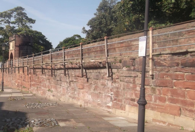
Part of City Wall. Late C11 to early C12 origin, converted to
raised promenade 1702-8 with subsequent repairs. Red coursed
rubble sandstone. Approx 1m north of the outer face of the
wall a retaining wall of large red sandstone blocks probably
replaces the earth bank. The south face of the wall has a 15m
length with 5 courses of large stones set back a little from
the face of adjoining lengths west and east, with a continuous
course of rounded corbels immediately below the wall walk and
thought to have been the base for the former inner timber
palisade.
This portion of the wall is approx 80m long; the wall walk is
nearly 2m wide.
St Martin's Gate 1966, bridging the gap cut to accommodate the
dual carriageway of the inner ring road, is not included in
this item.
(Bartholomew City Guides: Harris B: Chester: Edinburgh: 1979-:
85; The Buildings of England: Pevsner N & Hubbard E: Cheshire:
1971-: 155).
Listing NGR: SJ4017466596
External links are from the relevant listing authority and, where applicable, Wikidata. Wikidata IDs may be related buildings as well as this specific building. If you want to add or update a link, you will need to do so by editing the Wikidata entry.


Other nearby listed buildings
