Approximate Location Map
Large Map »
Latitude: 53.1936 / 53°11'36"N
Longitude: -2.8946 / 2°53'40"W
OS Eastings: 340325
OS Northings: 366648
OS Grid: SJ403666
Mapcode National: GBR 79.2Z7Z
Mapcode Global: WH887.HZTM
Plus Code: 9C5V54V4+C4
Entry Name: Part of City Wall Between Morgans Mount and Northgate
Listing Date: 28 July 1955
Last Amended: 6 August 1998
Grade: I
Source: Historic England
Source ID: 1376135
English Heritage Legacy ID: 470125
ID on this website: 101376135
Location: Chester, Cheshire West and Chester, Cheshire, CH1
County: Cheshire West and Chester
Electoral Ward/Division: Chester City
Parish: Non Civil Parish
Built-Up Area: Chester
Traditional County: Cheshire
Lieutenancy Area (Ceremonial County): Cheshire
Church of England Parish: Chester, St Peter
Church of England Diocese: Chester
Tagged with: City walls
CHESTER CITY (IM)
SJ4066NW CITY WALLS
595-1/1/107 Part of City Wall between Morgan's
28/07/55 Mount & Northgate
(Formerly Listed as:
City Walls & Towers incl.
foundations of SE angle Roman
Fortress wall & tower)
GV I
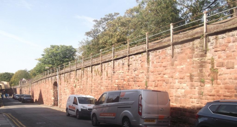
Part of City Walls incorporating Roman masonry. Probably early
C2, of the north wall of the legionary fortress; refortified
as part of City Wall late C11 to early C12, converted to
raised promenade 1702-8 and subsequently repaired. Coursed red
sandstone Roman ashlar and medieval and subsequent coursed
rubble. A segmental-arched opening through the wall opposite
Pemberton Road and a similar opening, rather narrower, with
iron gate opposite Canning Street. The north, outer, face to
the wall has 2 sections of the lower part of the Roman wall
standing proud of the face of the medieval wall; the west
section approx 18m long and up to 5 courses high plus
repositioned cornice stones and the east section approx 16m
long and up to 8 courses high with repositioned cornice
stones; the 2 sections are separated by the Canning Street
archway. The medieval wall has a twice weathered plinth partly
built on top of the Roman wall. A probable stone of the Roman
base course is visible 2m east of the wing-wall of the
Northgate.
This length of the wall is approx 316m long and 2m wide.
(Cheshire Sites and Monuments Record: Collens J: Chester City:
3000/1/3; Strickland TJ: Roman Chester: Nelson: 1984-1986:
PASSIM; The Buildings of England: Pevsner N & Hubbard E:
Cheshire: Harmondsworth: 1971-: 155).
Listing NGR: SJ4032566648
External links are from the relevant listing authority and, where applicable, Wikidata. Wikidata IDs may be related buildings as well as this specific building. If you want to add or update a link, you will need to do so by editing the Wikidata entry.


Other nearby listed buildings
