Latitude: 51.2326 / 51°13'57"N
Longitude: -0.3261 / 0°19'34"W
OS Eastings: 516963
OS Northings: 149488
OS Grid: TQ169494
Mapcode National: GBR HGJ.NCD
Mapcode Global: VHGS7.98GX
Plus Code: 9C3X6MMF+2H
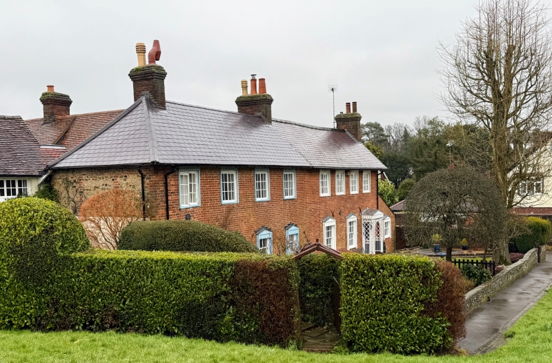
Entry Name: 12 and 13, Cotmandene
Listing Date: 11 June 1973
Grade: II
Source: Historic England
Source ID: 1378065
English Heritage Legacy ID: 289878
Also known as: 12 and 13
ID on this website: 101378065
Location: Dorking, Mole Valley, Surrey, RH4
County: Surrey
District: Mole Valley
Electoral Ward/Division: Dorking South
Parish: Non Civil Parish
Built-Up Area: Dorking
Traditional County: Surrey
Lieutenancy Area (Ceremonial County): Surrey
Church of England Parish: Dorking St Paul
Church of England Diocese: Guildford
Tagged with: Building
This list entry was subject to a Minor Amendment on 25 February 2025 to reformat the text to current standards.
TQ 1649 SE
1/221
COTMANDENE
Nos 12 and 13
GV
II
Circa 1800 front to a possibly timber framed core. Once used as a farmhouse. Two storeys. Eight windows. Brick. Slate roof with hip at western end; chimney stack in middle, one at western end and chimney breast on eastern wall. Two-light casement windows with flat topped window blinds above, and pediment shaped window blinds below. Wooden doors with similar style pediments over and trellised columns. North-south wing with old tiled roof behind, connecting with Rose Cottage.
Photograph in NMR.
Nos 11 to 13 (consec) form a group.
Listing NGR: TQ1696349488
External links are from the relevant listing authority and, where applicable, Wikidata. Wikidata IDs may be related buildings as well as this specific building. If you want to add or update a link, you will need to do so by editing the Wikidata entry.


Other nearby listed buildings