Approximate Location Map
Large Map »
Latitude: 51.468 / 51°28'4"N
Longitude: -0.0693 / 0°4'9"W
OS Eastings: 534201
OS Northings: 176102
OS Grid: TQ342761
Mapcode National: GBR XW.KY
Mapcode Global: VHGR6.RC6H
Plus Code: 9C3XFW9J+57
Entry Name: Walls, Gates and Railings to Girdlers Almshouses
Listing Date: 27 September 1972
Grade: II
Source: Historic England
Source ID: 1378479
English Heritage Legacy ID: 470780
ID on this website: 101378479
Location: Peckham, Southwark, London, SE15
County: London
District: Southwark
Electoral Ward/Division: The Lane
Parish: Non Civil Parish
Built-Up Area: Southwark
Traditional County: Surrey
Lieutenancy Area (Ceremonial County): Greater London
Church of England Parish: Peckham All Saints
Church of England Diocese: Southwark
Tagged with: Wall
SOUTHWARK
TQ3476 CHOUMERT ROAD
636-1/12/206 (North side)
27/09/72 Walls, gates and railings to
Girdlers' Almshouses
GV II
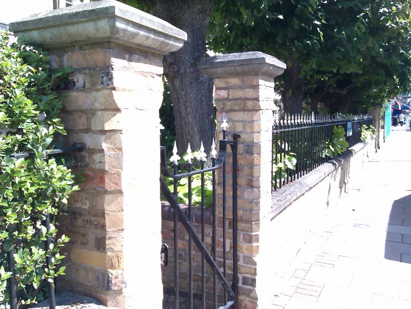
Low front brick wall with cast-iron railings, flanked by 2
sets of brick gate posts with cast-iron gates; end walls.
Listing NGR: TQ3420176102
External links are from the relevant listing authority and, where applicable, Wikidata. Wikidata IDs may be related buildings as well as this specific building. If you want to add or update a link, you will need to do so by editing the Wikidata entry.


Other nearby listed buildings
