Approximate Location Map
Large Map »
Latitude: 51.2077 / 51°12'27"N
Longitude: -2.6485 / 2°38'54"W
OS Eastings: 354792
OS Northings: 145588
OS Grid: ST547455
Mapcode National: GBR MN.42V8
Mapcode Global: VH89S.1XP1
Plus Code: 9C3V6952+3H
Entry Name: 16, Broad Street
Listing Date: 13 September 1972
Grade: II
Source: Historic England
Source ID: 1382888
English Heritage Legacy ID: 483274
ID on this website: 101382888
Location: Wells, Somerset, BA5
County: Somerset
District: Mendip
Civil Parish: Wells
Built-Up Area: Wells
Traditional County: Somerset
Lieutenancy Area (Ceremonial County): Somerset
Tagged with: Building
WELLS
ST5445 BROAD STREET
662-1/7/18 (West side)
13/09/72 No.16
GV II
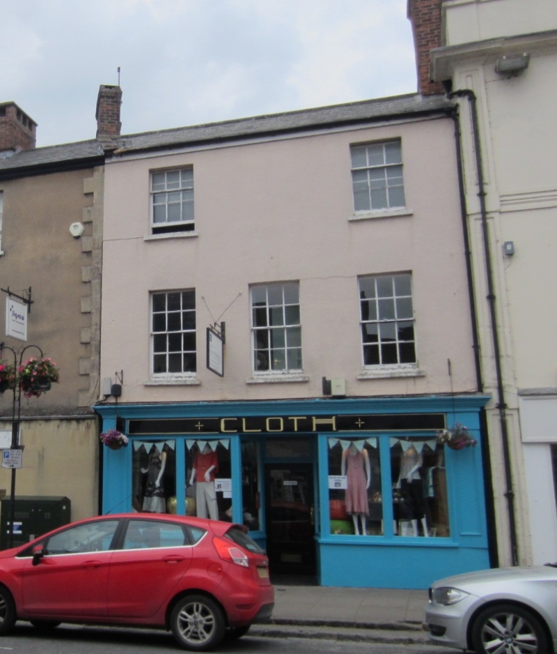
House with shop, now with offices. Early C19, modified.
Rendered and colourwashed, Welsh slate roof with coping to
south, abutment to north, rear slope pantile, brick chimney
stacks.
EXTERIOR: 3 storeys, 3 bays. Late C19 shop front with central
recessed doorway, plain side pilasters, shallow fascia under
cornice moulding, 2 vertical panes each side. At first floor
are three 12-pane sashes, and at second two 9-pane, the centre
without window. The rear wall is plain, rendered.
INTERIOR: not inspected.
Part of the development which took place soon after Broad
Street (formerly Wette or Water Lane) was widened in the years
1835-1849.
Listing NGR: ST5479245588
External links are from the relevant listing authority and, where applicable, Wikidata. Wikidata IDs may be related buildings as well as this specific building. If you want to add or update a link, you will need to do so by editing the Wikidata entry.


Other nearby listed buildings
