Approximate Location Map
Large Map »
Latitude: 51.2086 / 51°12'30"N
Longitude: -2.6449 / 2°38'41"W
OS Eastings: 355044
OS Northings: 145682
OS Grid: ST550456
Mapcode National: GBR MN.43QN
Mapcode Global: VH89S.3WLD
Plus Code: 9C3V6954+C2
Entry Name: Rear Boundary Wall to Town Hall
Listing Date: 31 May 2000
Grade: II
Source: Historic England
Source ID: 1383029
English Heritage Legacy ID: 483447
ID on this website: 101383029
Location: Wells, Somerset, BA5
County: Somerset
District: Mendip
Civil Parish: Wells
Built-Up Area: Wells
Traditional County: Somerset
Lieutenancy Area (Ceremonial County): Somerset
Tagged with: Architectural structure
WELLS
ST5445 MARKET PLACE
662-1/7/166 (South side)
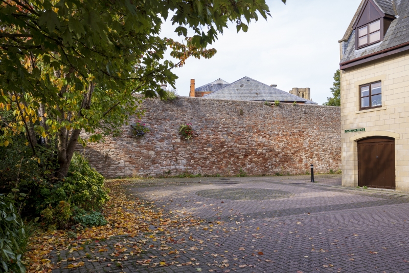
Rear boundary wall to Town Hall
GV II
Boundary wall. c1907, possibly incorporating work of the main
1799 building campaign. Rubble. The wall rises to approx 4m,
and runs across the full width of the site on its S side,
including one set-back in plan of approx 2m, and returns along
the full length of the W side, linking to the rear of the
principal range of the Town Hall. The wall is important not
only for defining the site, but also as a major visual element
to the open paved area lying to the S side.
Listing NGR: ST5504445682
External links are from the relevant listing authority and, where applicable, Wikidata. Wikidata IDs may be related buildings as well as this specific building. If you want to add or update a link, you will need to do so by editing the Wikidata entry.


Other nearby listed buildings
