Latitude: 52.538 / 52°32'16"N
Longitude: -2.809 / 2°48'32"W
OS Eastings: 345225
OS Northings: 293656
OS Grid: SO452936
Mapcode National: GBR BG.F739
Mapcode Global: VH75V.8GCQ
Plus Code: 9C4VG5QR+6C
Entry Name: Memorial 13 Metres South of West End of Nave of Church of St Lawrence
Listing Date: 29 February 2000
Grade: II
Source: Historic England
Source ID: 1383274
English Heritage Legacy ID: 483692
ID on this website: 101383274
Location: St Laurence's Church, Cunnery, Shropshire, SY6
County: Shropshire
Civil Parish: Church Stretton
Built-Up Area: Church Stretton
Traditional County: Shropshire
Lieutenancy Area (Ceremonial County): Shropshire
Church of England Parish: Church Stretton
Church of England Diocese: Hereford
Tagged with: Pedestal tomb
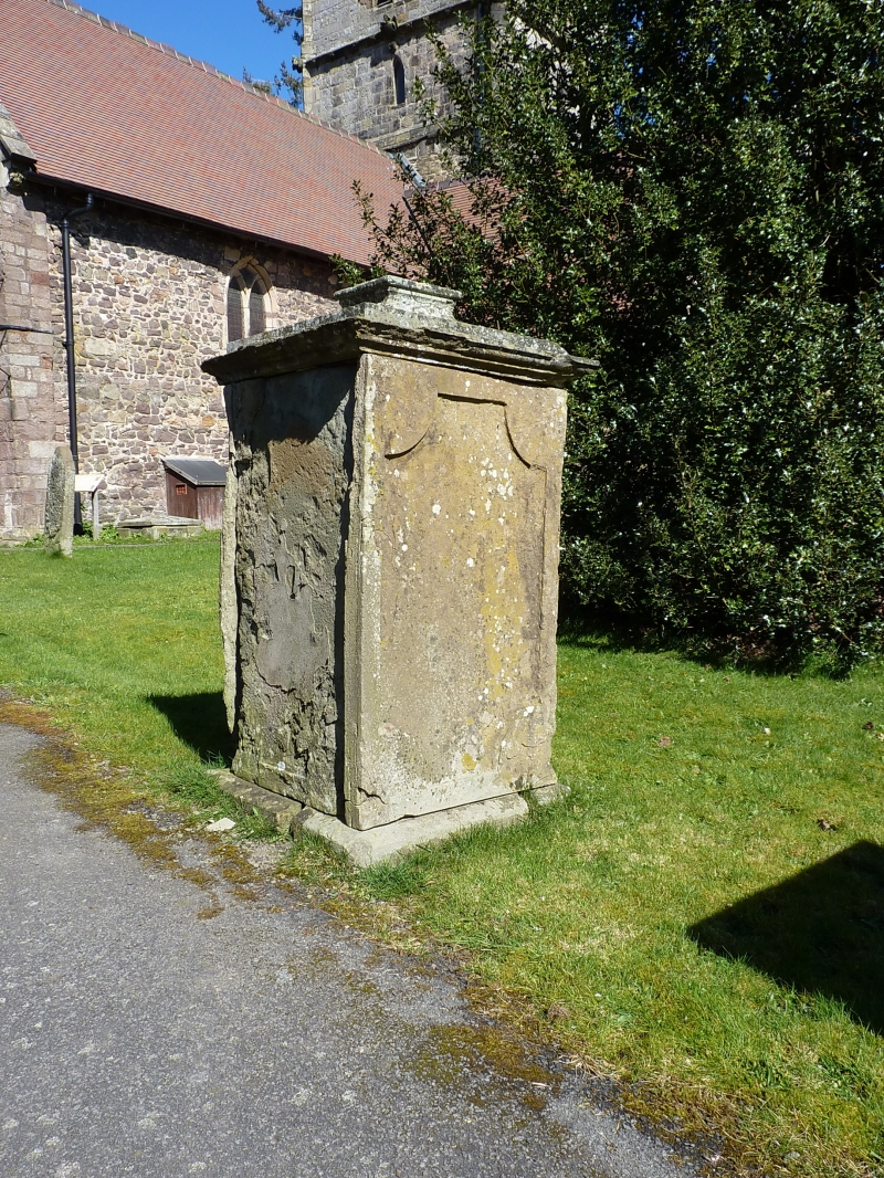
CHURCH STRETTON
SO4593 CHURCH STREET
1312-1/13/59 (East side)
Memorial 13 metres south of west end
of nave of Church of St Lawrence
GV II
Pedestal tomb. Early C19. Sandstone ashlar. Tented pyramid lid
with raised flat cap and with stepped and moulded cornice.
Inset panels with quadrant corners. Illegible inscription.
Included for group value.
Listing NGR: SO4522593656
External links are from the relevant listing authority and, where applicable, Wikidata. Wikidata IDs may be related buildings as well as this specific building. If you want to add or update a link, you will need to do so by editing the Wikidata entry.


Other nearby listed buildings