Approximate Location Map
Large Map »
Latitude: 54.2682 / 54°16'5"N
Longitude: -2.3533 / 2°21'12"W
OS Eastings: 377084
OS Northings: 485899
OS Grid: SD770858
Mapcode National: GBR DM02.9Q
Mapcode Global: WH94D.TZK8
Plus Code: 9C6V7J9W+7M
Entry Name: Stonehouse Bridge
Listing Date: 14 June 1984
Grade: II
Source: Historic England
Source ID: 1383942
English Heritage Legacy ID: 484374
ID on this website: 101383942
Location: Stone House, Westmorland and Furness, Cumbria, LA10
County: Cumbria
District: South Lakeland
Civil Parish: Dent
Traditional County: Yorkshire
Lieutenancy Area (Ceremonial County): Cumbria
Church of England Parish: Dent with Cowgill
Church of England Diocese: Carlisle
Tagged with: Bridge
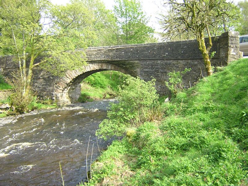
DENT
SD78NE DENTDALE
162-1/12/145 (North side)
14/06/84 Stonehouse Bridge
GV II
Public road bridge over River Dee. Probably C17, altered and
enlarged in C18 and C19. sandstone rubble. Narrow segmental
arch with rubble voussoirs (very large at the springing), with
squinches on the south side of the east end and the north side
of the west end, carrying widened roadway round sharp bends to
south and north respectively; stone slate band to parapets,
which have rounded coping stones. Forms group with West
Stonehouse farmhouse to east (qv) and with lime kiln approx.
30m to south (qv).
Listing NGR: SD7708485899
External links are from the relevant listing authority and, where applicable, Wikidata. Wikidata IDs may be related buildings as well as this specific building. If you want to add or update a link, you will need to do so by editing the Wikidata entry.


Other nearby listed buildings
