Approximate Location Map
Large Map »
Latitude: 51.4845 / 51°29'4"N
Longitude: -0.1 / 0°5'59"W
OS Eastings: 532026
OS Northings: 177884
OS Grid: TQ320778
Mapcode National: GBR PQ.P0
Mapcode Global: VHGR0.7Y0C
Plus Code: 9C3XFWM2+R2
Entry Name: 48-74, Lorrimore Road
Listing Date: 27 September 1972
Grade: II
Source: Historic England
Source ID: 1385672
English Heritage Legacy ID: 471076
ID on this website: 101385672
Location: Newington, Southwark, London, SE17
County: London
District: Southwark
Electoral Ward/Division: Newington
Parish: Non Civil Parish
Built-Up Area: Southwark
Traditional County: Surrey
Lieutenancy Area (Ceremonial County): Greater London
Church of England Parish: Newington St Paul
Church of England Diocese: Southwark
Tagged with: Building
SOUTHWARK
TQ3177 LORRIMORE ROAD
636-1/9/495 (North West side)
27/09/72 Nos.48-74 (Even)
II
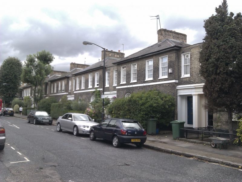
Terrace of 14 houses, 1852. Yellow stock brick with low
pitched, hipped slate roofs with deep eaves soffit and central
chimney stack.
Series of linked blocks of 2, each house 2 storeys with 2 bays
to main block (1 window to ground floor) and slightly set-back
parapeted entrance link block of 1 bay to each house.
Stucco pilasters and entablature to doors (paired in link
sections). Sash windows with margin lights in stucco lined
reveals, round-arched on ground floor (except Nos 64 & 66,
which are flat); with flat, gauged-brick arches on 1st floor.
Stucco string between floors.
INTERIOR: not inspected.
Listing NGR: TQ3202677884
External links are from the relevant listing authority and, where applicable, Wikidata. Wikidata IDs may be related buildings as well as this specific building. If you want to add or update a link, you will need to do so by editing the Wikidata entry.


Other nearby listed buildings
