Approximate Location Map
Large Map »
Latitude: 51.501 / 51°30'3"N
Longitude: -0.072 / 0°4'19"W
OS Eastings: 533918
OS Northings: 179771
OS Grid: TQ339797
Mapcode National: GBR WJ.Z3
Mapcode Global: VHGR0.PJSP
Plus Code: 9C3XGW2H+C5
Entry Name: Unity Wharf
Listing Date: 1 July 1983
Grade: II
Source: Historic England
Source ID: 1385711
English Heritage Legacy ID: 471117
ID on this website: 101385711
Location: Bermondsey, Southwark, London, SE1
County: London
District: Southwark
Electoral Ward/Division: Riverside
Parish: Non Civil Parish
Built-Up Area: Southwark
Traditional County: Surrey
Lieutenancy Area (Ceremonial County): Greater London
Church of England Parish: Bermondsey St James with Christ Church
Church of England Diocese: Southwark
Tagged with: Architectural structure
SOUTHWARK
TQ3379 MILL STREET
636-1/5/525 (West side)
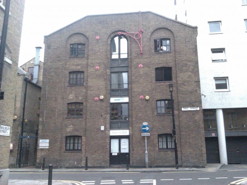
01/07/83 Unity Wharf
GV II
Warehouse, now in commercial use. c1850. Stock brick with
truncated gable front.
Plain rectangular building, 4 storeys, 3 bays. Windows (with
gauged-brick cambered heads) and central hatch rank (now
altered) contained in 3 full-height recesses with gauged-brick
round-headed arches. Front has circular tie-rod plates and
cast-iron pivot hoist with arched brace and circular bracing
to spandrel. Similar elevation to dockside with a flight of
granite steps cut into the dock wall to the right.
INTERIOR: not inspected.
Beginning of a good sequence of listed warehouses (qqv) along
the east side of St Saviour's Dock, which complements the west
Shad Thames side.
Listing NGR: TQ3391879771
External links are from the relevant listing authority and, where applicable, Wikidata. Wikidata IDs may be related buildings as well as this specific building. If you want to add or update a link, you will need to do so by editing the Wikidata entry.


Other nearby listed buildings
