Approximate Location Map
Large Map »
Latitude: 51.5057 / 51°30'20"N
Longitude: -0.0926 / 0°5'33"W
OS Eastings: 532476
OS Northings: 180256
OS Grid: TQ324802
Mapcode National: GBR RG.CD
Mapcode Global: VHGR0.BFX2
Plus Code: 9C3XGW44+7X
Entry Name: 20-26, Park Street
Listing Date: 27 September 1972
Grade: II
Source: Historic England
Source ID: 1385751
English Heritage Legacy ID: 471161
ID on this website: 101385751
Location: The Borough, Southwark, London, SE1
County: London
District: Southwark
Electoral Ward/Division: Cathedrals
Parish: Non Civil Parish
Built-Up Area: Southwark
Traditional County: Surrey
Lieutenancy Area (Ceremonial County): Greater London
Church of England Parish: St Saviour with All Hallows Southwark
Church of England Diocese: Southwark
Tagged with: Terrace of houses
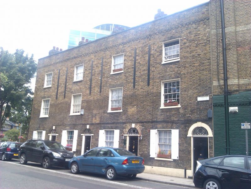
SOUTHWARK
TQ3280 PARK STREET
636-1/2/561 (North East side)
27/09/72 Nos.20-26 (Even)
II
Terrace of 4 houses. c1808. Yellow brick with brick dentil
cornice and parapet.
3 storeys, 1 window on each floor. Doors to right in
round-arched openings with rendered reveals, keys and impost
blocks and with patterned fanlights. Nos 24 & 26 have original
doors. Flat, gauged-brick arches to sash windows with glazing
bars in rendered reveals.
INTERIOR: not inspected.
Listing NGR: TQ3247880255
External links are from the relevant listing authority and, where applicable, Wikidata. Wikidata IDs may be related buildings as well as this specific building. If you want to add or update a link, you will need to do so by editing the Wikidata entry.


Other nearby listed buildings
