Approximate Location Map
Large Map »
Latitude: 51.5041 / 51°30'14"N
Longitude: -0.0324 / 0°1'56"W
OS Eastings: 536658
OS Northings: 180189
OS Grid: TQ366801
Mapcode National: GBR K4.VYB
Mapcode Global: VHGR1.DG79
Plus Code: 9C3XGX39+J2
Entry Name: Nelson Dry Dock Including Gate
Listing Date: 1 July 1983
Grade: II
Source: Historic England
Source ID: 1385846
English Heritage Legacy ID: 471265
ID on this website: 101385846
Location: Southwark, London, SE16
County: London
District: Southwark
Electoral Ward/Division: Surrey Docks
Parish: Non Civil Parish
Built-Up Area: Southwark
Traditional County: Surrey
Lieutenancy Area (Ceremonial County): Greater London
Church of England Parish: Rotherhithe Holy Trinity
Church of England Diocese: Southwark
Tagged with: Architectural structure
SOUTHWARK
TQ3680SE ROTHERHITHE STREET
636-1/21/663 (East side)
01/07/83 Nelson Dry Dock including gate
II
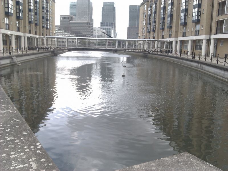
Dry dock, now filled as pond. Early to mid C19. Formerly
timber-lined, now refaced in concrete with original (altered)
wrought-iron caisson gate to river. Retaining wall with iron
plate ties (taken from ships) to road end.
Associated either with Randell and Brent or Bible and Perry's
ownership of Nelson Docks. One of the important surviving
Nelson's Dock constructions.
Listing NGR: TQ3665880189
External links are from the relevant listing authority and, where applicable, Wikidata. Wikidata IDs may be related buildings as well as this specific building. If you want to add or update a link, you will need to do so by editing the Wikidata entry.


Other nearby listed buildings
