Approximate Location Map
Large Map »
Latitude: 51.5046 / 51°30'16"N
Longitude: -0.048 / 0°2'52"W
OS Eastings: 535572
OS Northings: 180210
OS Grid: TQ355802
Mapcode National: GBR J9.Y9T
Mapcode Global: VHGR1.3FZY
Plus Code: 9C3XGX32+RQ
Entry Name: Surrey Lock Including Gates, Bollards and Capstans
Listing Date: 1 July 1983
Grade: II
Source: Historic England
Source ID: 1385847
English Heritage Legacy ID: 471266
ID on this website: 101385847
Location: Shadwell, Southwark, London, SE16
County: London
District: Southwark
Electoral Ward/Division: Surrey Docks
Parish: Non Civil Parish
Built-Up Area: Southwark
Traditional County: Surrey
Lieutenancy Area (Ceremonial County): Greater London
Church of England Parish: Rotherhithe St Mary with All Saints
Church of England Diocese: Southwark
Tagged with: Lock
SOUTHWARK
TQ3580 ROTHERHITHE STREET
636-1/3/664 Surrey Lock including gates,
01/07/83 bollards and capstans
GV II
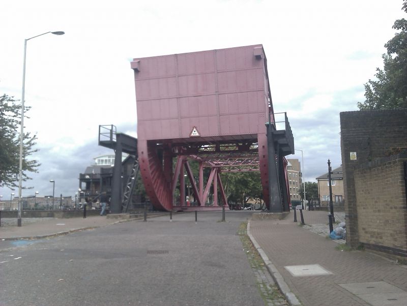
Lock. c1860 By Jennings, engineer. Brick lined with granite
kerbs, cast-iron bollards and capstans. Double iron-clad lock
gates, originally hydraulically powered. Lock side now
restored and lock filled up to gates.
Industrial archaeological interest. A good example of lock
design at the start of the second period of dock expansion.
Also forms good group with Rotherhithe Tunnel air shaft (qv).
Listing NGR: TQ3557280210
External links are from the relevant listing authority and, where applicable, Wikidata. Wikidata IDs may be related buildings as well as this specific building. If you want to add or update a link, you will need to do so by editing the Wikidata entry.


Other nearby listed buildings
