Approximate Location Map
Large Map »
Latitude: 51.5043 / 51°30'15"N
Longitude: -0.0756 / 0°4'32"W
OS Eastings: 533661
OS Northings: 180129
OS Grid: TQ336801
Mapcode National: GBR WG.5X
Mapcode Global: VHGR0.MGX5
Plus Code: 9C3XGW3F+PQ
Entry Name: Horseley Down Old Stairs and Hard
Listing Date: 1 July 1983
Last Amended: 17 September 1998
Grade: II
Source: Historic England
Source ID: 1385906
English Heritage Legacy ID: 471325
ID on this website: 101385906
Location: Wapping, Southwark, London, SE1
County: London
District: Southwark
Electoral Ward/Division: Riverside
Parish: Non Civil Parish
Built-Up Area: Southwark
Traditional County: Surrey
Lieutenancy Area (Ceremonial County): Greater London
Church of England Parish: Bermondsey St Mary Magdalen, St Olave, St John and St Luke
Church of England Diocese: Southwark
Tagged with: Architectural structure
SOUTHWARK
TQ3380 SHAD THAMES
636-1/2/690 (North side)
01/07/83 Horsley Down Old Stairs and Hard
(Formerly Listed as:
RIVER STAIRS AND HARDS, Surrey Shore
Horsley Down Old Stairs and Hard)
II
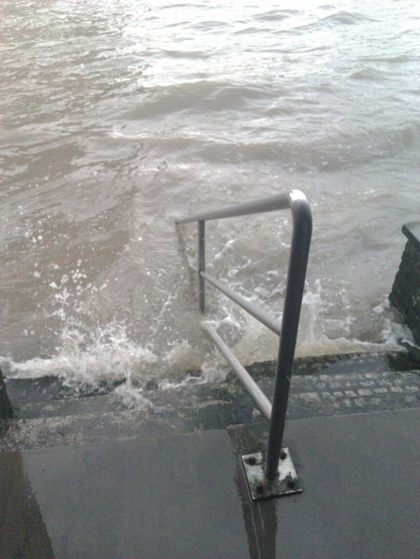
Stone stairs leading down to stone flagged hard, the name
appearing on Roque's map of 1746. Approached from the land
through the Anchor Brewhouse, via a new flight of steps.
Listing NGR: TQ3366180129
External links are from the relevant listing authority and, where applicable, Wikidata. Wikidata IDs may be related buildings as well as this specific building. If you want to add or update a link, you will need to do so by editing the Wikidata entry.


Other nearby listed buildings
