Latitude: 53.4839 / 53°29'1"N
Longitude: -2.2479 / 2°14'52"W
OS Eastings: 383644
OS Northings: 398599
OS Grid: SJ836985
Mapcode National: GBR DHG.Y4
Mapcode Global: WHB9G.FPSK
Plus Code: 9C5VFQM2+GR
Entry Name: Blackfriars Bridge (That Part in Salford Civil Parish)
Listing Date: 4 February 1988
Grade: II
Source: Historic England
Source ID: 1386078
English Heritage Legacy ID: 471502
ID on this website: 101386078
Location: Salford, M3
County: Salford
Electoral Ward/Division: Ordsall
Parish: Non Civil Parish
Built-Up Area: Manchester
Traditional County: Lancashire
Lieutenancy Area (Ceremonial County): Greater Manchester
Church of England Parish: Salford Sacred Trinity
Church of England Diocese: Manchester
SALFORD
SJ8398NE BLACKFRIARS BRIDGE STREET
949-1/21/7 Blackfriars Bridge (that part in
04/02/88 Salford CP)
GV II
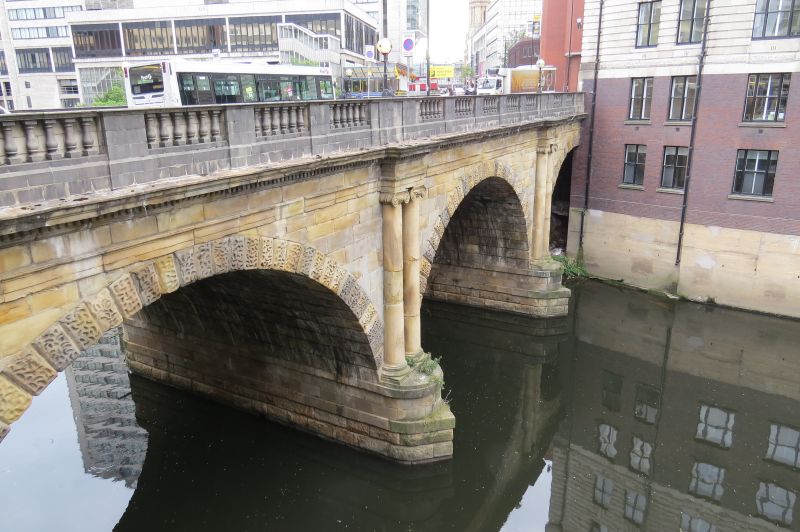
Bridge. c1820. Stone and cast-iron. 3 semicircular arches
partly embedded in river bank constructed on a slope. Paired
Ionic pilasters each side of central arch, and vermiculated
rustication to voussoirs. Parapet renewed, with balustrading
on outer face. See also Manchester CP.
Listing NGR: SJ8365298581
This text is from the original listing, and may not necessarily reflect the current setting of the building.


Other nearby listed buildings