Latitude: 51.8941 / 51°53'38"N
Longitude: -2.0755 / 2°4'31"W
OS Eastings: 394897
OS Northings: 221728
OS Grid: SO948217
Mapcode National: GBR 2MB.B29
Mapcode Global: VH947.ZN3C
Plus Code: 9C3VVWVF+JQ
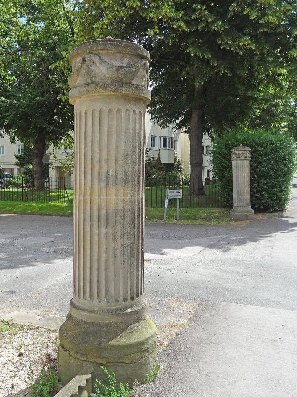
Entry Name: Group of Five Drive Piers to Numbers 114 to 136
Listing Date: 14 December 1983
Last Amended: 26 November 1998
Grade: II
Source: Historic England
Source ID: 1386723
English Heritage Legacy ID: 474119
ID on this website: 101386723
Location: Montpellier, Cheltenham, Gloucestershire, GL53
County: Gloucestershire
District: Cheltenham
Electoral Ward/Division: College
Parish: Non Civil Parish
Built-Up Area: Cheltenham
Traditional County: Gloucestershire
Lieutenancy Area (Ceremonial County): Gloucestershire
Church of England Parish: Cheltenham St Luke and St John
Church of England Diocese: Gloucester
Tagged with: Architectural structure
CHELTENHAM
SO9421NE BATH ROAD 630-1/18/174 (South East side) 14/12/83 Group of five drive piers to Nos.114-136 (even) (Formerly Listed as: BATH ROAD (East side) Drive-piers to Nos.114-136 (even))
GV II
Five piers to carriage sweep. c1823 with later C19 adaptation for gas and late C20 restorations. North piers and northern of the central piers are fluted cylindrical ashlar piers with moulded necking and carved rams'-heads on moulding above. Three are capped by iron tripods with tapering fluted gasoliers. Only one pier at south end: fluted with swagged masks in frieze and carved capping. The north piers are more worn. The lamps were originally fitted for oil. A significant streetscape feature, forming an integral part of the setting for Nos 114-136 (even) Bath Road (qqv). (Chatwin A: Cheltenham's Ornamental Ironwork: Cheltenham: 1975-1984: 61).
Listing NGR: SO9490621717
External links are from the relevant listing authority and, where applicable, Wikidata. Wikidata IDs may be related buildings as well as this specific building. If you want to add or update a link, you will need to do so by editing the Wikidata entry.


Other nearby listed buildings