Latitude: 51.9012 / 51°54'4"N
Longitude: -2.0761 / 2°4'34"W
OS Eastings: 394859
OS Northings: 222517
OS Grid: SO948225
Mapcode National: GBR 2M4.PYK
Mapcode Global: VH947.YGTX
Plus Code: 9C3VWW2F+FH
Entry Name: Churchyard wall, piers and railings to east of Church of St Mary
Listing Date: 14 December 1983
Last Amended: 26 November 1998
Grade: II
Source: Historic England
Source ID: 1386794
English Heritage Legacy ID: 474193
ID on this website: 101386794
Location: Cheltenham, Gloucestershire, GL50
County: Gloucestershire
District: Cheltenham
Electoral Ward/Division: Lansdown
Parish: Non Civil Parish
Built-Up Area: Cheltenham
Traditional County: Gloucestershire
Lieutenancy Area (Ceremonial County): Gloucestershire
Church of England Parish: Cheltenham, St Mary with St Matthew
Church of England Diocese: Gloucester
Tagged with: Churchyard wall
This list entry was subject to a Minor Amendment on 24 July 2025 to reformat the text to current standards
SO9422NE
630-1/9/250
CHELTENHAM
CHURCH STREET
Churchyard wall, piers and railings to east of Church of St Mary
(Formerly Listed as: CHURCH STREET Churchyard wall to south-east of Parish Church of St Mary)
14/12/83
GV
II
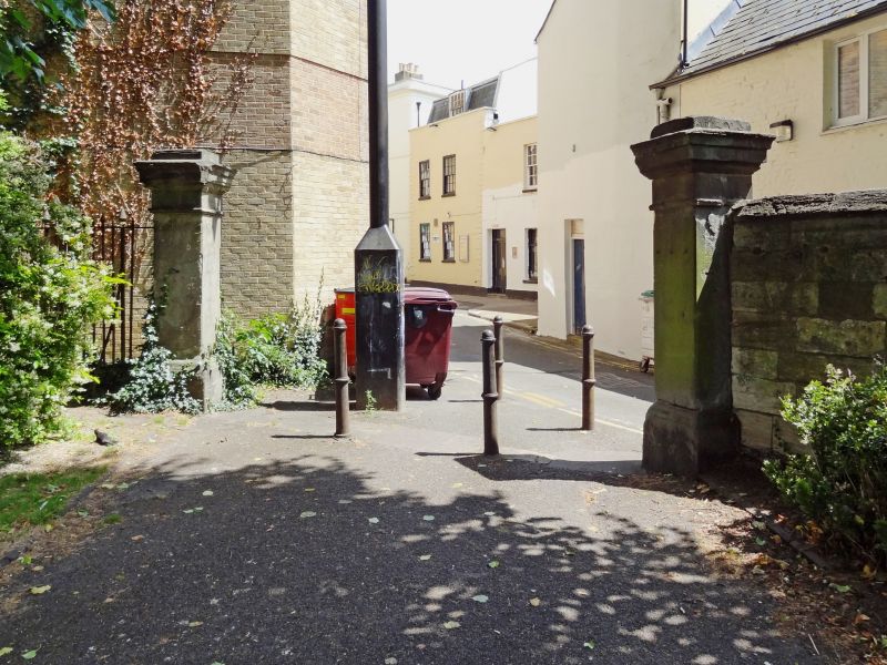
Churchyard wall, entrance piers, end pier and railings. Mid C19. Wall to south-east of church approximately 1.5m high; coursed rubble with flat coping stones, about 35m long. End piers, square on plan, approximately 2m high, with crowning frieze, moulded cornice and raised caps. Further similar pier to west forms entrance, then spearhead railings to north-east for approx 10m on low wall.
Forms a significant part of the setting of Church of St Mary (qv), the railings abut walls and piers at rear of Nos 210-216 High Street (qv).
Listing NGR: SO9485822516
External links are from the relevant listing authority and, where applicable, Wikidata. Wikidata IDs may be related buildings as well as this specific building. If you want to add or update a link, you will need to do so by editing the Wikidata entry.


Other nearby listed buildings