Latitude: 52.1098 / 52°6'35"N
Longitude: -2.0757 / 2°4'32"W
OS Eastings: 394909
OS Northings: 245723
OS Grid: SO949457
Mapcode National: GBR 2JM.Q0M
Mapcode Global: VH938.Z70G
Plus Code: 9C4V4W5F+WP
Entry Name: 17, Broad Street
Listing Date: 11 February 1965
Last Amended: 30 March 1999
Grade: II
Source: Historic England
Source ID: 1387010
English Heritage Legacy ID: 474426
ID on this website: 101387010
Location: Pershore, Wychavon, Worcestershire, WR10
County: Worcestershire
District: Wychavon
Civil Parish: Pershore
Built-Up Area: Pershore
Traditional County: Worcestershire
Lieutenancy Area (Ceremonial County): Worcestershire
Church of England Parish: Pershore
Church of England Diocese: Worcester
Tagged with: Building
SO9445
648-1/5/80
11/02/65
PERSHORE
BROAD STREET
(North side)
No.17
(Formerly Listed as:
BROAD STREET
(North side)
Nos.15 AND 17)
GV
II
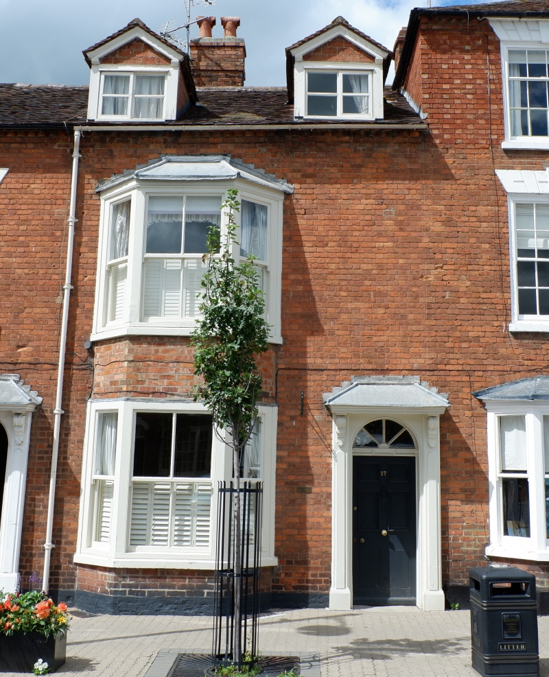
House in row. Late C18/early C19, remodelled later C19 and
C20. Red brick in Flemish bond. Plain tile roof with 2
inserted roof dormers, brick dogtooth eaves, and off-ridge
brick stack.
EXTERIOR: 2 storeys and attic; single-window range. Dormers
are gabled and have C20 2-light casements and barge-boards. On
left, added 2-storey canted bay-window with pitched leaded
roof and 1/1:2/2:1/1 sashes.
Doorcase on right has pilasters; decorative brackets
supporting cornice and pitched leaded hood; fanlight with
radial glazing bars; and 6-panel door. Plinth courses.
INTERIOR: not inspected.
Listing NGR: SO9490945723
External links are from the relevant listing authority and, where applicable, Wikidata. Wikidata IDs may be related buildings as well as this specific building. If you want to add or update a link, you will need to do so by editing the Wikidata entry.


Other nearby listed buildings