Approximate Location Map
Large Map »
Latitude: 50.8001 / 50°48'0"N
Longitude: -1.097 / 1°5'49"W
OS Eastings: 463733
OS Northings: 100445
OS Grid: SU637004
Mapcode National: GBR VQ2.TK
Mapcode Global: FRA 86LZ.GG9
Plus Code: 9C2WRW23+26
Entry Name: Hms Nelson: Victory Main Gate
Listing Date: 8 July 1998
Grade: II
Source: Historic England
Source ID: 1387147
English Heritage Legacy ID: 475056
Also known as: Victory Gate, HMS Nelson
ID on this website: 101387147
Location: Portsea, Portsmouth, Hampshire, PO1
County: City of Portsmouth
Electoral Ward/Division: Charles Dickens
Parish: Non Civil Parish
Built-Up Area: Portsmouth
Traditional County: Hampshire
Lieutenancy Area (Ceremonial County): Hampshire
Church of England Parish: Portsea St George
Church of England Diocese: Portsmouth
Tagged with: Architectural structure
PORTSMOUTH
SU6300 QUEEN STREET
774-1/8/102 (North side)
08/07/98 HMS Nelson: Victory Main Gate
GV II
Formerly known as: HMS Victory QUEEN STREET.
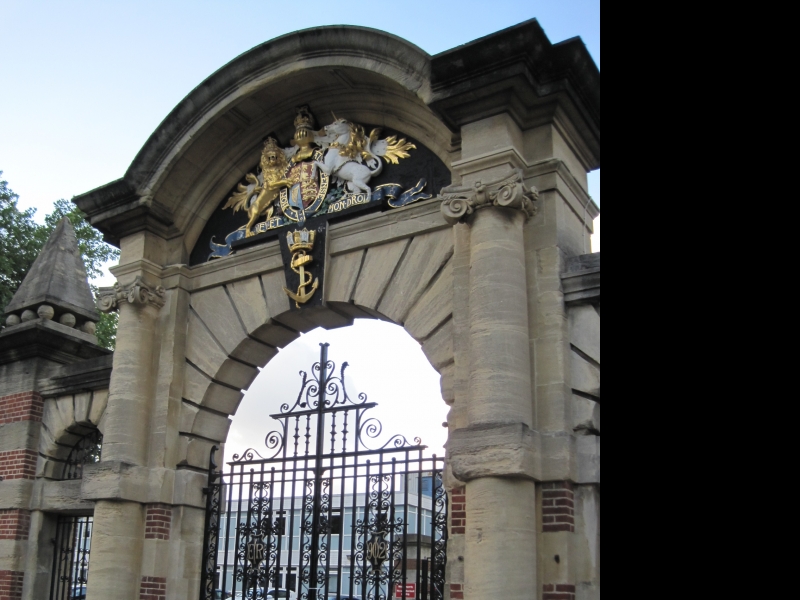
Entrance to naval barracks re-using parts from former Portsea
Quay Gate. Dated 1902, reused parts 1734. Superintendent
Engineer Sir Henry Pilkington RE. Red brick and ashlar. Banded
piers with roll-moulded plinths, deep cornices and blocking
courses, outer piers with pyramid-on-ball finials. Taller and
wider central gateway with flanking pedestrian gateways, all
having rusticated round arches. Impost band carried across
pedestrian gateways, and moulded cornice with blocking course
above them. Central archway flanked by reused attached Ionic
columns and with Admiralty crest on keystone which rises into
corniced segmental pediment in which is carved and painted
royal coat of arms. Central gates have decorative panels with
royal cipher and date.
HISTORY: formed the formal entrance to the first naval
barracks in Portsmouth, and part of a group with the fine
officer's quarters opposite (qv).
Listing NGR: SU6373200461
External links are from the relevant listing authority and, where applicable, Wikidata. Wikidata IDs may be related buildings as well as this specific building. If you want to add or update a link, you will need to do so by editing the Wikidata entry.


Other nearby listed buildings
