Latitude: 51.9066 / 51°54'23"N
Longitude: -2.0775 / 2°4'39"W
OS Eastings: 394764
OS Northings: 223119
OS Grid: SO947231
Mapcode National: GBR 2M4.HKS
Mapcode Global: VH947.YB2R
Plus Code: 9C3VWW4C+JX
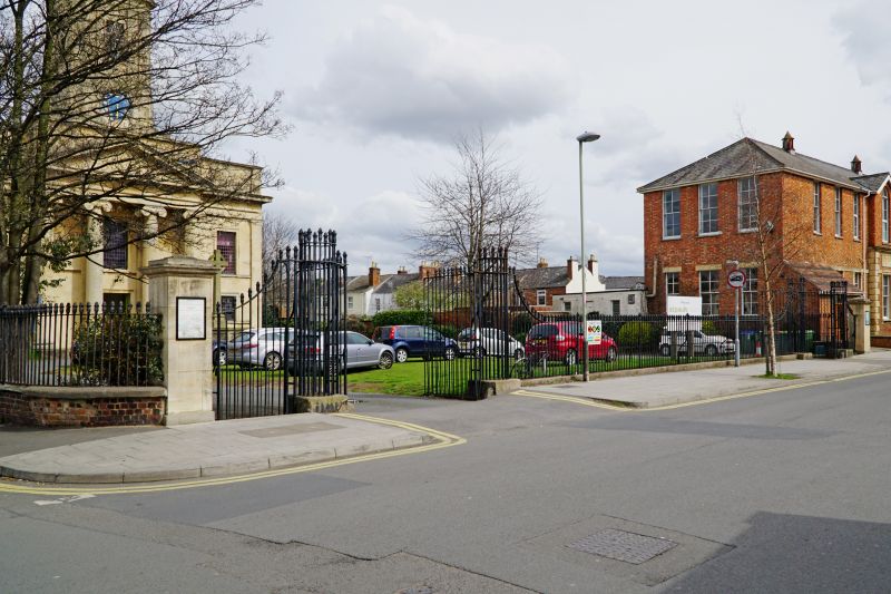
Entry Name: Railings Walls Gates and Gate Piers to Church of St Paul
Listing Date: 14 December 1983
Last Amended: 26 November 1998
Grade: II
Source: Historic England
Source ID: 1387884
English Heritage Legacy ID: 475877
ID on this website: 101387884
Location: St Paul's Church, St Paul's, Cheltenham, Gloucestershire, GL50
County: Gloucestershire
District: Cheltenham
Electoral Ward/Division: St Paul's
Parish: Non Civil Parish
Built-Up Area: Cheltenham
Traditional County: Gloucestershire
Lieutenancy Area (Ceremonial County): Gloucestershire
Church of England Parish: Cheltenham St Paul
Church of England Diocese: Gloucester
Tagged with: Wall Gate Guard rail Gatepost
CHELTENHAM
SO9423SE ST PAUL'S ROAD 630-1/5/845 (North side) 14/12/83 Railings, walls, gates and gate piers to Church of St Paul (Formerly Listed as: ST PAUL'S ROAD (North side) Railings and piers to Church of St Paul to Hanover Street and St Paul's Road)
GV II
Railings, walls, gates and gate piers. c1831. U-plan with, to front, symmetrical arrangement of outer gate piers and pedestrian gates adjoining the set of piers and double gates, with railings between for approx 14m; to right return railings on low wall for approx 8m; to left return railings on low walls for approx 30m. Cast-iron railings, outer ashlar piers and pinkish-brown brick walls. Outer piers are square on plan and have moulded capping. Lotus-head railings, ramped up to open, circular-plan gate piers made of railings. Double gates and pedestrian gates also lotus-head. Railings returned to west end (Hanover Street) as far as portico; returned to east about 10m. Forms a significant streetscape feature to St Paul's Road and Hanover Street.
Listing NGR: SO9476423119
External links are from the relevant listing authority and, where applicable, Wikidata. Wikidata IDs may be related buildings as well as this specific building. If you want to add or update a link, you will need to do so by editing the Wikidata entry.


Other nearby listed buildings