Latitude: 51.9065 / 51°54'23"N
Longitude: -2.0771 / 2°4'37"W
OS Eastings: 394795
OS Northings: 223112
OS Grid: SO947231
Mapcode National: GBR 2M4.HP2
Mapcode Global: VH947.YB9T
Plus Code: 9C3VWW4F+J5
Entry Name: St Pauls Community Centre
Listing Date: 5 May 1972
Grade: II
Source: Historic England
Source ID: 1387906
English Heritage Legacy ID: 475900
ID on this website: 101387906
Location: St Paul's, Cheltenham, Gloucestershire, GL50
County: Gloucestershire
District: Cheltenham
Electoral Ward/Division: St Paul's
Parish: Non Civil Parish
Built-Up Area: Cheltenham
Traditional County: Gloucestershire
Lieutenancy Area (Ceremonial County): Gloucestershire
Church of England Parish: Cheltenham St Paul
Church of England Diocese: Gloucester
Tagged with: Architectural structure
CHELTENHAM
SO9423SE ST PAUL'S ROAD 630-1/5/848 (North side) 05/05/72 St Paul's Community Centre (Formerly Listed as: ST PAUL'S ROAD Former St Paul's Primary School)
GV II
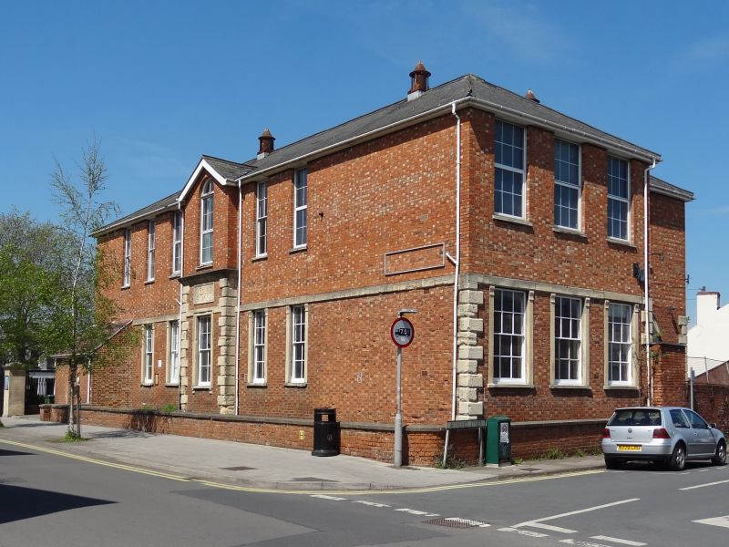
School, now community centre. c1830-50. Flemish bond brick with stone dressings; hipped Welsh slate roof with ventilators; brick rear stack. L-plan with rear right wing. EXTERIOR: 2 storeys, 6 first-floor windows. Long front to street has slightly-projecting central pedimented bay semicircular arched window above cornice and rusticated quoins framing ground-floor 4/4 sash set in moulded architrave and inscription panel over. 2-window range to right and 3-window range to left with 2/2 pane sashes: ground floor sashes set in raised stone architraves with console brackets flush to storey band; later C19 lean-to to left of front with fish-scale tiles and segmental-arched door. Similar 3-window range elevations to left and right. Rear wing has semicircular stone arch with drip mould over blocked entry to right. INTERIOR: not inspected.
Listing NGR: SO9479223120
External links are from the relevant listing authority and, where applicable, Wikidata. Wikidata IDs may be related buildings as well as this specific building. If you want to add or update a link, you will need to do so by editing the Wikidata entry.


Other nearby listed buildings