Latitude: 51.8913 / 51°53'28"N
Longitude: -2.0709 / 2°4'15"W
OS Eastings: 395216
OS Northings: 221413
OS Grid: SO952214
Mapcode National: GBR 2MB.K6L
Mapcode Global: VHB1Q.2Q1J
Plus Code: 9C3VVWRH+GJ
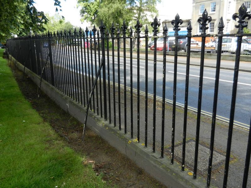
Entry Name: Railings to Cheltenham College Grounds
Listing Date: 14 December 1983
Last Amended: 26 November 1998
Grade: II
Source: Historic England
Source ID: 1387931
English Heritage Legacy ID: 475925
ID on this website: 101387931
Location: Coltham Fields, Cheltenham, Gloucestershire, GL53
County: Gloucestershire
District: Cheltenham
Electoral Ward/Division: College
Parish: Non Civil Parish
Built-Up Area: Cheltenham
Traditional County: Gloucestershire
Lieutenancy Area (Ceremonial County): Gloucestershire
Church of England Parish: Cheltenham St Luke and St John
Church of England Diocese: Gloucester
Tagged with: Guard rail
CHELTENHAM
SO9521SW SANDFORD ROAD 630-1/24/797 (South side) 14/12/83 Railings to Cheltenham College grounds (Formerly Listed as: SANDFORD ROAD Railings to Cheltenham College grounds ... up to the College and Gymnasium)
GV II
Includes: Railings to Cheltenham College grounds THIRLESTAINE ROAD. Includes: Railings to Cheltenham College grounds COLLEGE LAWN. Railings and gates. c1840-60. Stone plinth, alternate spear head and fleurs-de-lys head iron railings. Fleurs-de-lys standards with dogleg stanchions. Railings extend for approx 230m along Sandford Road and with approx 160m to College Lawn, then approx 45m to Thirlestaine Road. Double gates and pedestrian gate to Sandford Road have arrowhead bars. A significant streetscape feature, forming part of the setting for Cheltenham College, Bath Road (qv). Abuts and forms a continuous unit with Cheltenham College Gymnasium, Pavilion, Fives Courts and attached railings, Thirlestaine Road (qv).
Listing NGR: SO9521621412
External links are from the relevant listing authority and, where applicable, Wikidata. Wikidata IDs may be related buildings as well as this specific building. If you want to add or update a link, you will need to do so by editing the Wikidata entry.


Other nearby listed buildings