Approximate Location Map
Large Map »
Latitude: 52.5359 / 52°32'9"N
Longitude: -2.4296 / 2°25'46"W
OS Eastings: 370956
OS Northings: 293206
OS Grid: SO709932
Mapcode National: GBR BY.FBL9
Mapcode Global: VH83H.TJX9
Plus Code: 9C4VGHPC+95
Entry Name: Conduit Head, Corner of Westgate and Ludlow Road
Listing Date: 19 October 2007
Grade: II
Source: Historic England
Source ID: 1392279
English Heritage Legacy ID: 503734
ID on this website: 101392279
Location: High Town, Shropshire, WV16
County: Shropshire
Civil Parish: Bridgnorth
Built-Up Area: Bridgnorth
Traditional County: Shropshire
Lieutenancy Area (Ceremonial County): Shropshire
Church of England Parish: Bridgnorth
Church of England Diocese: Hereford
Tagged with: Architectural structure
BRIDGNORTH
823/0/10111 Conduit Head, corner of Westgate and
19-OCT-07 Ludlow Road
II
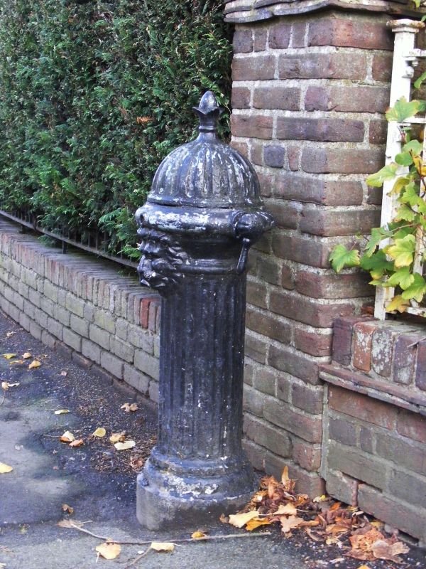
A water conduit head, dating from c.1900, situated on the south side of the street at the corner of Westgate and Ludlow Road. The structure is of cast iron, with a circular profile to the upright. The conduit head is in the form of a fat, fluted upright with three lion heads towards the top, and a domed, gadrooned top with a foliate finial; the tap is in the form of a dolly peg to the right hand side. Water was dispensed through the spout in the mouth of the lion head to the front of the conduit head.
HISTORY: Bridgnorth has a long history of a piped municipal water supply, beginning in the C14 when friars from the Franciscan Friary had created a system of wooden water pipes bringing spring water into the part of the town where the Friary was situated. In the C18, unfiltered water was pumped via a water wheel from the River Severn to a 6,500 gallon cistern on Castle Hill; it was piped to the homes of those who could afford to rent the service. Alongside this service, spring water was supplied free of charge via conduits throughout the town. In 1829, an underground reservoir was provided in the High Street at the south end of the Guildhall; by this time, Bridgnorth was becoming popular for its healthy atmosphere, and its population grew steadily. However, in 1849, 67 people died in a short period from cholera, and the town's water provision was reviewed. A new system was put in place in 1853, using an improved reservoir drawing filtered water from the River Severn, and in 1857 an enlarged river abstraction works which pumped water to sand filter beds above the town was opened, from where water was supplied by gravity throughout the town; this system remained in use until the 1970s, since when water has been supplied via boreholes. The conduit heads which survive date from several phases: c.1871, c.1900, c.1920s and c.1930s.
REASONS FOR DESIGNATION DECISION:
The water conduit head at the corner of Westgate and Ludlow Road is listed at Grade II for the following principal reasons:
* A well-cast, highly decorative example of a street conduit head, surviving intact and unaltered
* Part of the public and visible expression of the provision of a safe and comprehensive municipal water supply
External links are from the relevant listing authority and, where applicable, Wikidata. Wikidata IDs may be related buildings as well as this specific building. If you want to add or update a link, you will need to do so by editing the Wikidata entry.


Other nearby listed buildings
