Latitude: 55.7003 / 55°42'1"N
Longitude: -3.6257 / 3°37'32"W
OS Eastings: 297923
OS Northings: 646401
OS Grid: NS979464
Mapcode National: GBR 323J.VF
Mapcode Global: WH5SF.8ZQG
Plus Code: 9C7RP92F+4P
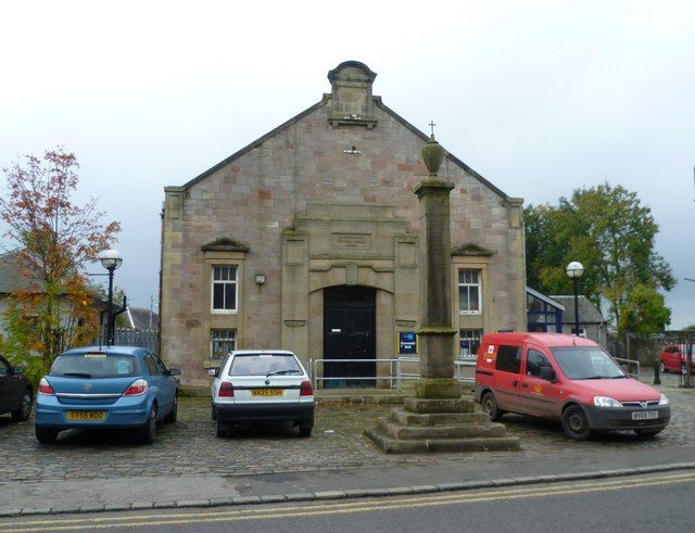
Entry Name: Cross, Main Street, Carnwath
Listing Name: Carnwath Cross
Listing Date: 12 January 1971
Category: A
Source: Historic Scotland
Source ID: 331081
Historic Scotland Designation Reference: LB694
Building Class: Cultural
Also known as: Carnwath Cross
Carnwath, Main Street, Cross
ID on this website: 200331081
Location: Carnwath
County: South Lanarkshire
Electoral Ward: Clydesdale East
Parish: Carnwath
Traditional County: Lanarkshire
Tagged with: Market cross
17th century.
External links are from the relevant listing authority and, where applicable, Wikidata. Wikidata IDs may be related buildings as well as this specific building. If you want to add or update a link, you will need to do so by editing the Wikidata entry.


Other nearby listed buildings