Approximate Location Map
Large Map »
Latitude: 55.7004 / 55°42'1"N
Longitude: -3.6249 / 3°37'29"W
OS Eastings: 297976
OS Northings: 646416
OS Grid: NS979464
Mapcode National: GBR 324J.0D
Mapcode Global: WH5SF.9Z3C
Plus Code: 9C7RP92G+52
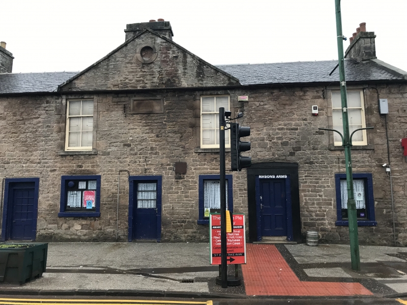
Entry Name: 74 Main Street, Carnwath
Listing Name: Nos. 74-78 Main Street
Listing Date: 21 April 1980
Category: B
Source: Historic Scotland
Source ID: 331084
Historic Scotland Designation Reference: LB697
Building Class: Cultural
Also known as: Carnwath, 74 Main Street
ID on this website: 200331084
Location: Carnwath
County: South Lanarkshire
Electoral Ward: Clydesdale East
Parish: Carnwath
Traditional County: Lanarkshire
Tagged with: Pub
Freemasons Hall, 1813
External links are from the relevant listing authority and, where applicable, Wikidata. Wikidata IDs may be related buildings as well as this specific building. If you want to add or update a link, you will need to do so by editing the Wikidata entry.


Other nearby listed buildings
