Approximate Location Map
Large Map »
Latitude: 56.7018 / 56°42'6"N
Longitude: -2.4373 / 2°26'14"W
OS Eastings: 373322
OS Northings: 756758
OS Grid: NO733567
Mapcode National: GBR VZ.1V9H
Mapcode Global: WH8RK.JTM6
Plus Code: 9C8VPH27+P3
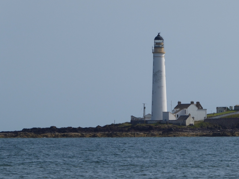
Entry Name: Lighthouse, Montroseness
Listing Name: Scurdie Ness Lighthouse (Montroseness Lighthouse)
Listing Date: 11 June 1971
Category: B
Source: Historic Scotland
Source ID: 336272
Historic Scotland Designation Reference: LB4958
Building Class: Cultural
Also known as: Montroseness, Lighthouse
ID on this website: 200336272
Location: Craig
County: Angus
Electoral Ward: Montrose and District
Parish: Craig
Traditional County: Angus
Tagged with: Lighthouse
Circular graduated column... ft. high, white washed
brick with stone dressings, terminating in W.I. balcony
with lantern light and dome. 1870.
Navigational, in use as such.
External links are from the relevant listing authority and, where applicable, Wikidata. Wikidata IDs may be related buildings as well as this specific building. If you want to add or update a link, you will need to do so by editing the Wikidata entry.


Other nearby listed buildings
