Approximate Location Map
Large Map »
Latitude: 57.1153 / 57°6'54"N
Longitude: -3.8982 / 3°53'53"W
OS Eastings: 285147
OS Northings: 804301
OS Grid: NH851043
Mapcode National: GBR J9RX.F2L
Mapcode Global: WH4JD.2FZ6
Plus Code: 9C9R4482+4P
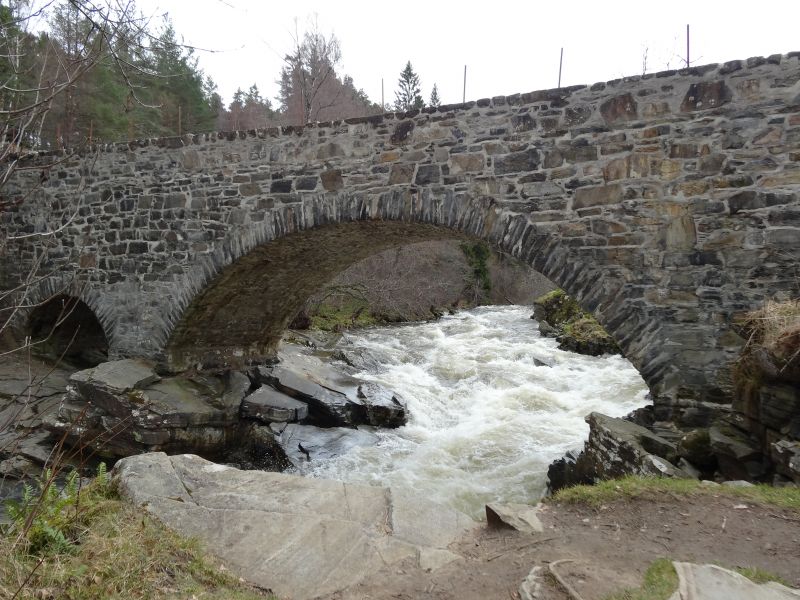
Entry Name: Feshie Bridge
Listing Name: Feshiebridge, Bridge over River Feshie
Listing Date: 5 October 1971
Category: B
Source: Historic Scotland
Source ID: 339630
Historic Scotland Designation Reference: LB7667
Building Class: Cultural
ID on this website: 200339630
Location: Kingussie and Insh
County: Highland
Electoral Ward: Badenoch and Strathspey
Parish: Kingussie And Insh
Traditional County: Inverness-shire
Tagged with: Bridge Road bridge
Later 18th century, high single span rubble bridge
springing from natural rock abutments with small flood
arch at E bank. Dressed rubble arch rings; low dressed
rubble coped parapet.
Approximate span; 40', 12' flood arch.
Bridge survived 1829 floods.
External links are from the relevant listing authority and, where applicable, Wikidata. Wikidata IDs may be related buildings as well as this specific building. If you want to add or update a link, you will need to do so by editing the Wikidata entry.


Other nearby listed buildings
