Approximate Location Map
Large Map »
Latitude: 56.6547 / 56°39'17"N
Longitude: -2.5119 / 2°30'43"W
OS Eastings: 368710
OS Northings: 751555
OS Grid: NO687515
Mapcode National: GBR VX.9W1C
Mapcode Global: WH8RQ.DZ2S
Plus Code: 9C8VMF3Q+V6
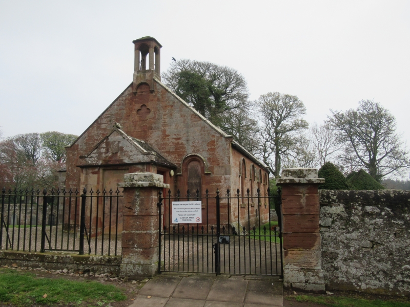
Entry Name: Lunan Parish Church
Listing Name: Lunan Parish Kirk
Listing Date: 11 June 1971
Category: B
Source: Historic Scotland
Source ID: 345239
Historic Scotland Designation Reference: LB12439
Building Class: Cultural
ID on this website: 200345239
Location: Lunan
County: Angus
Electoral Ward: Arbroath East and Lunan
Parish: Lunan
Traditional County: Angus
Tagged with: Church building
Small oblong Romanesque, ashlar and slate, with belfry
and projecting porch. Dated MDCCCXLIV. Baptismal basin and
sandglass stand dated 1733.
Ecclesiastical in use as such.
External links are from the relevant listing authority and, where applicable, Wikidata. Wikidata IDs may be related buildings as well as this specific building. If you want to add or update a link, you will need to do so by editing the Wikidata entry.


Other nearby listed buildings
