Approximate Location Map
Large Map »
Latitude: 56.6541 / 56°39'14"N
Longitude: -2.5113 / 2°30'40"W
OS Eastings: 368746
OS Northings: 751483
OS Grid: NO687514
Mapcode National: GBR VX.9W5G
Mapcode Global: WH8RX.D0CQ
Plus Code: 9C8VMF3Q+JF
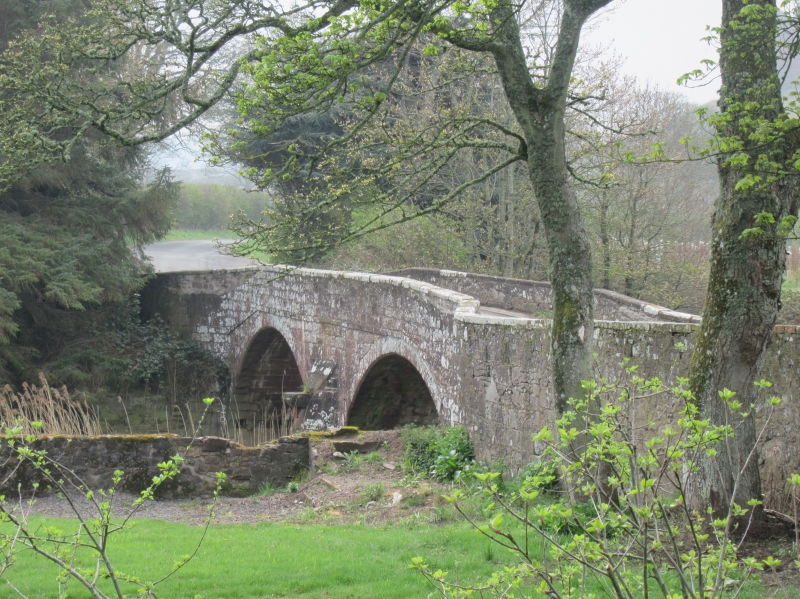
Entry Name: Lunan Bridge
Listing Name: Lunan Bridge over Lunan Water
Listing Date: 11 June 1971
Category: B
Source: Historic Scotland
Source ID: 345240
Historic Scotland Designation Reference: LB12440
Building Class: Cultural
ID on this website: 200345240
Location: Lunan
County: Angus
Electoral Ward: Arbroath East and Lunan
Parish: Lunan
Traditional County: Angus
Tagged with: Bridge
Narrow two segmental arch hump bridge, ashlar, with cut-
water and parapets widening at approaches. 18th cent.,
repaired c.1850.
External links are from the relevant listing authority and, where applicable, Wikidata. Wikidata IDs may be related buildings as well as this specific building. If you want to add or update a link, you will need to do so by editing the Wikidata entry.


Other nearby listed buildings
