Approximate Location Map
Large Map »
Latitude: 56.6561 / 56°39'21"N
Longitude: -2.5127 / 2°30'45"W
OS Eastings: 368665
OS Northings: 751705
OS Grid: NO686517
Mapcode National: GBR VX.9NFW
Mapcode Global: WH8RQ.CYQR
Plus Code: 9C8VMF4P+CW
Entry Name: The Dales, Lunan
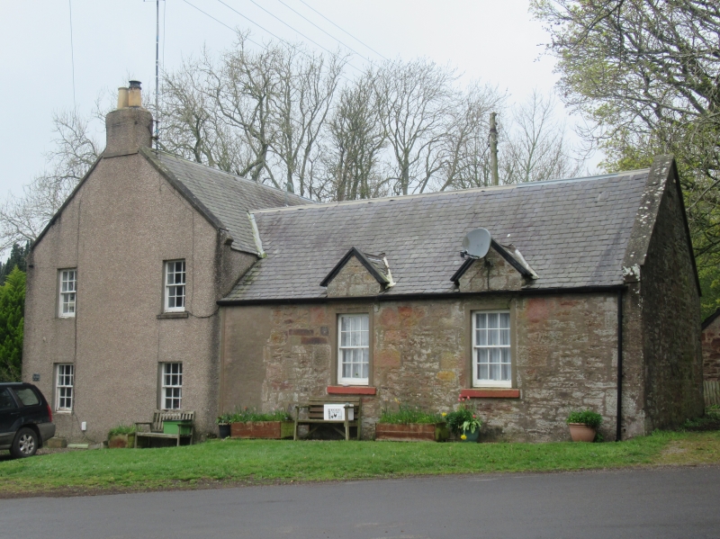
Listing Name: Kirkton of Lunan, Old Schoolhouse
Listing Date: 11 June 1971
Category: C
Source: Historic Scotland
Source ID: 345241
Historic Scotland Designation Reference: LB12441
Building Class: Cultural
ID on this website: 200345241
Location: Lunan
County: Angus
Electoral Ward: Arbroath East and Lunan
Parish: Lunan
Traditional County: Angus
Tagged with: Architectural structure
Two-storey, harl and slate. Late 18th cent. with single-
storey schoolroom added early 19th cent. Remodelled and
subdivided into dwelling houses c.1850.
Re-categorised as C(S) from B for Group. The listing refers specifically to the group interest of the subject. It applies, as always, to interior as well as exterior, as appropriate to building type.
External links are from the relevant listing authority and, where applicable, Wikidata. Wikidata IDs may be related buildings as well as this specific building. If you want to add or update a link, you will need to do so by editing the Wikidata entry.


Other nearby listed buildings
