Approximate Location Map
Large Map »
Latitude: 55.9045 / 55°54'16"N
Longitude: -4.3175 / 4°19'3"W
OS Eastings: 255212
OS Northings: 670360
OS Grid: NS552703
Mapcode National: GBR 053.V4
Mapcode Global: WH3NV.NV7D
Plus Code: 9C7QWM3J+RX
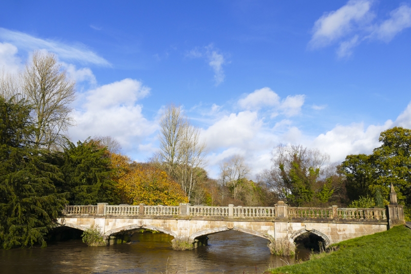
Entry Name: Bridge, Garscube Park, Bearsden
Listing Name: Bridge in Garscube Park
Listing Date: 14 May 1971
Category: B
Source: Historic Scotland
Source ID: 357597
Historic Scotland Designation Reference: LB22132
Building Class: Cultural
Also known as: Bearsden, Garscube Park, Bridge
ID on this website: 200357597
Location: Bearsden
County: East Dunbartonshire
Town: Bearsden
Electoral Ward: Bearsden South
Traditional County: Dunbartonshire
Tagged with: Bridge Footbridge
Spanning River Kelvin, originally principal approach to
Garscube House. 4 flat pointed stone arches with ribs;
balustraded parapet has "Tudor" style decoration. Architect,
William Burn, 1826.
County Boundary
External links are from the relevant listing authority and, where applicable, Wikidata. Wikidata IDs may be related buildings as well as this specific building. If you want to add or update a link, you will need to do so by editing the Wikidata entry.


Other nearby listed buildings
